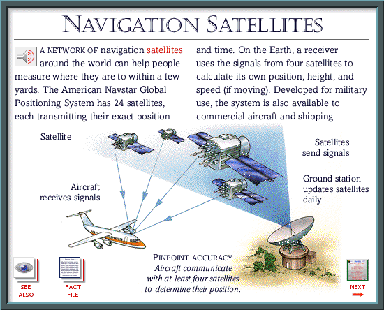
Labels:text | screenshot | aircraft OCR: NAVIGATION SATELLITES A NETWORK OF navigation satellites and time. On the Earth, a receiver around the world can help people uses the signals from four satellites to measure where they are to within a few calculate its own position, height, and yards. The American Navstar Global speed (if moving). Developed for military Positioning System has 24 satellites, use, the system is also available to each transmitting their exact position commercial aircraft and shipping. Satellite Satellites send signals Aircraft Ground station receives signals updates satellites daily PINPOINT ACCURACY Aircraft communicate with at least four satellites SEE FACT to determine their position. NEXT ALSO FILE