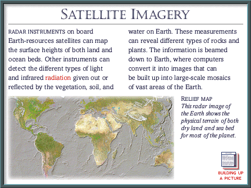
Labels:text | screenshot | map OCR: SATELLITE IMAGERY RADAR INSTRUMENTS on board water on Earth. These measurements Earth-resources satellites can map can reveal different types of rocks and the surface heights of both land and plants. The information is beamed ocean beds. Other instruments can down to Earth, where computers detect the different types of light convert it into images that can and infrared radiation given out or be built up into large-scale mosaics reflected by the vegetation, soil, and of vast areas of the Earth. RELIEF MAP This radar image of the Earth shows the physical terrain of both dry land and sea bed for most of the planet. BUILDING UP A PICTURE