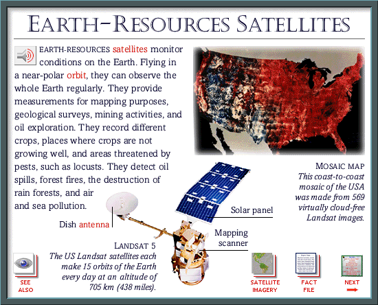
Labels:text | screenshot OCR: EARTH-RESOURCES SATELLITES EARTH-RESOURCES satellites monitor conditions on the Earth. Flying in a near-polar orbit, they can observe the whole Earth regularly. They provide measurements for mapping purposes, geological surveys, mining activities, and oil exploration. They record different crops, places where crops are not growing well, and areas threatened by pests, such as locusts. They detect oil MOSAIC MAP spills, forest fires, the destruction of This coast-to-coast rain forests, and air mosaic of the USA and sea pollution. was made from 569 Solar panel virtually cloud-free Dish antenna Landsat images. Mapping LANDSAT 5 scanner The US Landsat satellites each make 15 orbits of the Earth every day at an altitude of SEE SATELLITE NEXT ALSO 705 km (438 miles). FACT IMAGERY FILE