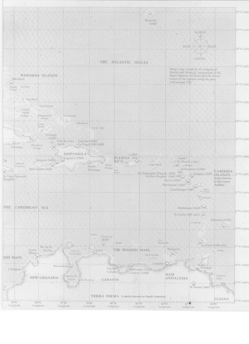
Labels:text | diagram | parallel | plan | schematic | technical drawing OCR: 30'N Lati Bermuda (1640) 29'N Lati NORTH WES EAST 28'N Lati . SOUTH THE ATLANTIC OCEAN 27'N Lati Being a map created by the Company of "Butcher and Hendrick, cartographers to His BAHAMAS ISLANDS Royal Highness, and based upon the diverse Eleuthera travels of Sea Capteins during the years 1560 terougit 1700 26'N Latit ExwHa Cat Island Sound Long, Island 25'N Lati Crockal Island Crooked isiand Passage Chicos INarsds Passage 24'N Latil Great g Turks Islands North Kill Tortuga (1620) 23'N Lati Port-de-Paix Isabella (1560) Santiago Windward (1660) La Vega K1600-1640) HISPANIOLA PCERTO Juan 22'N Latit Anguilla CA Leogane (1660) Yaguanı (1560) RICO Gr Martin (1640) Jamsich Santo Mon Virgin Islands Petit Goave(1620) Domingo Passage St. Eustatius (1640) St.Christophe (French, 1620) CARIBBEE Antigua ...