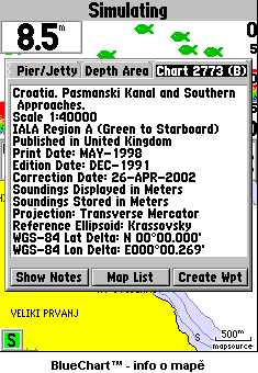
Labels:clock | monitor | plant | road | sky | stairs | web site | window OCR: Pier/Jetty Depth Area Chort B Crogtig. Pasmanski Kanal and Southern APProoches Scale 1:40000 IALA Region (Green to Starboard) Published In United Kingdom Print Date: MAY- 1998 Edition Date: DEC 66 Correction Date: APR- 2002 Snunpunns Displayed in leters Soundings Stored In Te ter Projection: Transverse Mercator Reference Ellipsoid: .Krassovsky WGS- 84 Lat Delta: N0 00.000 WGS- 84 Lon Delta: EO0O 00 269 Show Hotes Map Lis Create Wpt VELIKI PRYANJ 500 mapsource BlueChart -info o mape Simulating Chart 2773 Crootio Storboord ercatol Selto EOOO List PRYAHJ mane