 St. Paul-en-Forêt
Provence-Beyond (Beyond the French Riviera) ®
Var (83440)
Population: 812
Altitude: 320 m
Nearby:
[ Bagnols-en-Forêt | Gorges du Blavet | Fayence | Lac de St. Cassien ]
Photos:
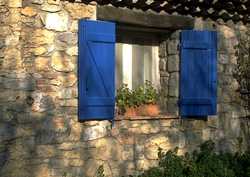
A bigger view of the blue-shutter house
The church clock-bell tower with warning bell on top
 St. Paul is located in an area of low hills heavily forested in pine and oak, in a region known for its "Provence" wine, olives and cork.
St. Paul, sitting in a clearing amidst the pine forests south of Fayence and west of the Lac de St. Cassien, is probably very nice for living; many houses are situated in the surrounded woods.
St. Paul is located in an area of low hills heavily forested in pine and oak, in a region known for its "Provence" wine, olives and cork.
St. Paul, sitting in a clearing amidst the pine forests south of Fayence and west of the Lac de St. Cassien, is probably very nice for living; many houses are situated in the surrounded woods.
The village doesn't seem very attractive for visiting, though. The buildings are tight against the roads passing through, and there are no little streets or "old village" or even any fountains to speak of. Even sitting on the end of this wooded ridge, the view isn't very good from the village, and the village itself can't be seen from a distance.
The location, however, is beautiful, with the forests all around the village.
Name
First record, 11th century: Sanctus Paulus de Gallina Grasse;
named St-Paul-lez-Fayence in 1824 when it was detached from the commune of Fayence.
History
Prehistoric:
Stone-age artifacts were discovered at Saquetons, a hamlet 3 km to the north.
Celtic-Ligurian; Gallo-Roman:
St. Paul has traces of a Celtic-Ligurian site, and Gallo-Roman vestiges, including tombs and tiles.
Medieval:
In the 13th century, St. Paul was attached to the Abbey of Lérins, and then to the Villeneuve domain.
The glass industry was strong here in the 17th century,
when the huge "dames Jeanne" bottles were produced, in remembrance of the passage of the Reine Jeanne.
Dates
Fête: 3rd Sunday in Aug
Foire: 25 Jan
Hiking
Maps: IGN 3543 est "fayence" (1:25,000); Didier Richard #25 (1:50,000).
Bagnols-en-Forêt is about 3 km to the south, separated by forests and river valleys. There are some small trails here, but the area is also blocked by private estates and houses.
There are many marked trails to the west in Les Maures, including the Grande Randonnée GR51 which comes up from the Gorges du Blavet about 12 km south.