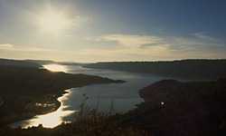
 Lac de Ste. Croix
Provence-Beyond (Beyond the French Riviera) ®
Length: 12 km; width 2-4 km
Var (83)
Area: 2,200 ha
Altitude: 475 m
Nearby:
[ Aups 15 km | Bauduen 0 | Moustiers-Ste-Marie 6 | Riez 10 | Observatoire de Bauduen | Grand Canyon du Verdon ]
Photos:
Larger photo of this sunset over the lake (14k)
Verdon river gorge entering the lake (28k)
 This magnificant turquiose lake was formed by the Barrage (dam) de Ste. Croix, built on the Verdon river in 1975. Sitting on the open Plateau de Valensole and the Grand Plan de Canjuers, the lake has a feeling of endless space and light. At the northeastern end of the lake at the Pont du Galetas, an almost invisible slot in the mountain wall hides the deep, wild Verdon canyon where the rushing green waters of the river enter the lake.
There is easy acces to much of the lake shore, and pleanty of beaches and picnic areas. The size of the lake, however, accepts the summer visitors without a feeling of overcrowding its vast surface.
Although the village of Ste-Croix-de-Verdon gave the lake its name, the village of Les Salles-sur-Verdon on the opposite side is more a part of the lake itself: the old village rests 40 m below the surface of the water. When the dam was built, Les Salles-sur-Verdon moved to higher ground, taking some of the old village with it, including the church belltower and the fountain.
Sports.
Boat, canoe and sailboard rental is available from just a few places, including the village of Bauduen at the southern tip of the lake, and the village of Ste-Croix-de-Verdon along the northwestern shore.
A centre équestre is located on the plains of the northwestern shore, near the village of Ste-Croix-de-Verdon. Other riding stables are located at Moustiers-Ste-Marie and at the Château de Chanteraine near Les Salles-sur-Verdon on the eastern side of the lake. There are many riding trails in the area, and one of them follows the GR99 hiking trail along the southeastern side of the lake.
Hiking.
Maps: IGN 3442 ouest, 3443 ouest (1:25,000); Didier Richard #19 (1:50,000).
The grande randonnée GR99 passes the lake along the southeastern side. To the west, the GR99 goes by the village of Artignosc-sur-Verdon and the lower Gorges du Verdon. To the east, the GR99 goes the full length of the fabulous Grand Canyon du Verdon, along the southern edge through the Cornishe Sublime.
The GR4 passes to the north of the lake, connecting Moustiers-Ste-Marie with Riez, Allemagne-en-Provence and Gréoux-les-Bains to the west and passing along the north side of the Grand Canyon du Verdon to Castellane in the east.
- Camping
- Les Salles-sur Verdon:
- Les Pins - tel: (33) 494 70 20 80; fax: (33) 494 84 23 27; apr-oct
- Ls Source - tel: (33) 494 70 20 40; fax: (33) 494 70 20 74; apr-oct
- Near the villages: Bauduen, Ste-Croix-de-Verdon and Les Salles-sur-Verdon (on the northeastern shore).
- At the northeastern end of the lake, just south of the Pont du Galetas.
- At the northeastern end of the lake, along the road going north towards Moustiers-Ste-Marie.