|
2 of 5 |
 |
Find and Illustrate Business Data on Maps
Quickly Pinpoint Customer or Business Locations
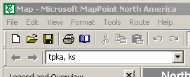
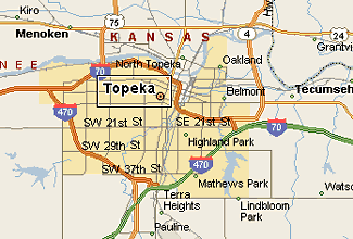
Need to find a county, city, or even a specific street address in the United States or Canada? Simply type in your information to get a set of possible matches. Provide exact information and Microsoft MapPoint™ 2001 zooms to the best map view. The Intelligent Location Find feature swiftly resolves misspellings and omissions—for instance, returning "Topeka, Kansas," when asked to find
"tpka, ks."

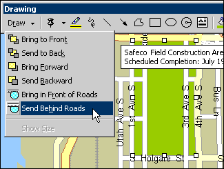
Annotate Your Map: Add Directions, Shapes, and Text
Customize your map by using familiar Office family drawing tools. MapPoint 2001 has adapted these tools to make them specific to annotating maps. For example, you can place objects behind roads on a street-level map by using the Send Behind Roads command.
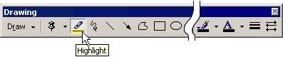
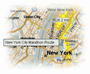
Highlight Your Route and Calculate the Distance
Draw a highlighted line to show a route or an area of interest on a map. The distance covered by the highlighted route can be displayed on the map in miles or kilometers.
Customize Your Map View and Navigation
 | Choose street-level or broader views with one of four predefined styles: road map, data map, terrain map, or flat map.
| | Scale up or down:
 | With the Microsoft IntelliMouse®, use the handy Zoom slider to choose from a range of pan and zoom options.
| | Navigate among scale views with the active, hierarchical navigation bar (for example, North America, United States, Kansas, Topeka). The dynamic scale indicates miles or kilometers in the current view.
|
|
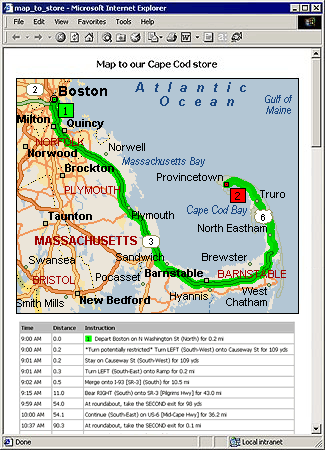
Make Your Maps Mobile
Print out your maps for easy reference. Export your map to a handheld computer running Pocket Streets (requires Microsoft Windows® CE). Or, save your map as an .html file and post it on a Web site for instant access anywhere.
|