 Earth Viewer: Credits
Earth Viewer: Credits
Earth Viewer: Credits
The satellite tracking code is based upon the N3EMO Orbit Simulator:
            N3EMO Orbit Simulator routines  v3.7

   Copyright ⌐ 1986,1987,1988,1989,1990 Robert W. Berger N3EMO
   May be freely distributed, provided this notice remains intact.
The GIF output file generation is based upon the
ppmtogif
module of Jef Poskanzer's
pbmplus toolkit, of which many
other components were used in creating the images you see here.
   ppmtogif.c - read a portable pixmap and produce a GIF file

   Based on GIFENCOD by David Rowley [mgardi@watdscu.waterloo.edu].
   Lempel-Ziv compression based on "compress".

   Modified by Marcel Wijkstra [wijkstra@fwi.uva.nl]

   Copyright ⌐ 1989 by Jef Poskanzer.

   Permission to use, copy, modify, and distribute this software and its
   documentation for any purpose and without fee is hereby granted, provided
   that the above copyright notice appear in all copies and that both that
   copyright notice and this permission notice appear in supporting
   documentation.  This software is provided "as is" without express or
   implied warranty.

   The Graphics Interchange Format⌐ is the Copyright property of
   CompuServe Incorporated.  GIF(sm) is a Service Mark property of
   CompuServe Incorporated.
Steven Grimm's
uncgi
made the task of processing form arguments in the server immeasurably
easier.
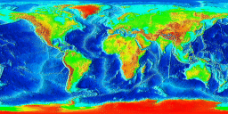
The global topographic map
was developed by the
Marine Geology and Geophysics Division
of the National Geophysical Data Center
operated by the United States Department of Commerce,
National Oceanic and Atmospheric Administration.
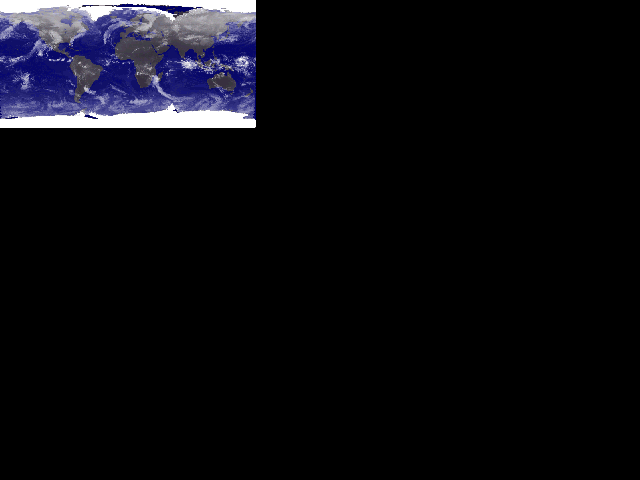
The cloudy Earth image is generated on the fly, every three hours,
from the whole-Earth weather satellite pictures made available by
the University of Wisconsin-Madison Space Science and
Engineering Center's
Gopher server.
I take this image,
then transform it from the Mollweide projection in which it is
published to the Mercator projection expected by Earth Viewer's image
generator (thanks to code from the GCTPc package:
ftp://edcftp.cr.usgs.gov/pub/software/gctpc/gctpc.tar.Z)
Then the image is contrast stretched, gamma corrected, and composited
with a cartoon image of the Earth (too much detail in the terrain
washes out the clouds) using tools from the pbmplus package
described above.
All the images have been modified somewhat to align them with the map projection and to adjust the colour map for the night and day display.
The algorithms to calculate the position of the Sun and Moon are given in:
Meeus, Jean. Astronomical Algorithms. Richmond: Willmann-Bell, 1991. ISBN 0-943396-35-2.