| Capes and Headlands |
| Capes or headlands on a coastline are promontories which extend into the sea. A rugged coast will have many capes but they can form anywhere; on long, more uniform stretches of coast, capes are sometimes the cusps dividing two curved bays like Cape Fear on the North Carolina Coast, USA. Also on the east coast of the USA, Cape Cod, shaped by strong ocean currents which move sand along the coast. Constant replenishment keeps the strange shaped headland from being washed away.
Capes are commonly outcroppings of resistant rock. Along some coastlines faults which lie at right angles to the shore can be exploited by the sea and widened. Where there are several types of rock along a stretch of coast the sea removes softer materials forming gentle bays and the harder rocks more slowly, so that they form headlands. Particularly large or elongated capes are called peninsulas. Rocky headlands, because they are prominent features, are often important visual navigation aids. A good example is the Cape of Good Hope, South Africa, first sighted by Portuguese explorer Bartolomeu Dias in 1488. Cape Horn on Isla Hornos at the southern tip of Tierra del Fuego Archipelago, is a similarly well known cape. It was named by the Dutch Navigator Willem Schouten who named the headland 'Hoorn' after his birthplace when he sailed around it in 1616. Both Cape Horn and the Cape of Good Hope are renowned for the stormy weather and rough seas which prevail there. Navigation of Cape Horn is particularly hazardous. 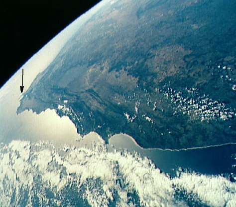 Photographed from the Space Shuttle, the coast of South Africa. An arrow picks out the Cape of Good Hope. Cape Aquihas, the continent's southernmost point, is clearly visible just below it. |

| Links | ||||
|