
JCUMetSat GMS Weather Pictures
Provided by:
James Cook University of North Queensland
Department of Electrical and Computer Engineering
using images received from the GMS Satellite which is
operated by the Japan Meteorological Agency (JMA)
James Cook University of North Queensland
Department of Electrical and Computer Engineering
using images received from the GMS Satellite which is
operated by the Japan Meteorological Agency (JMA)
Please note the new location of the web page and the images (7 Jan 97)
A backup logging machine and web page is now available.
There have been accesses to this page.
To redistribute these images see conditions of use
The latest pictures received are show below:
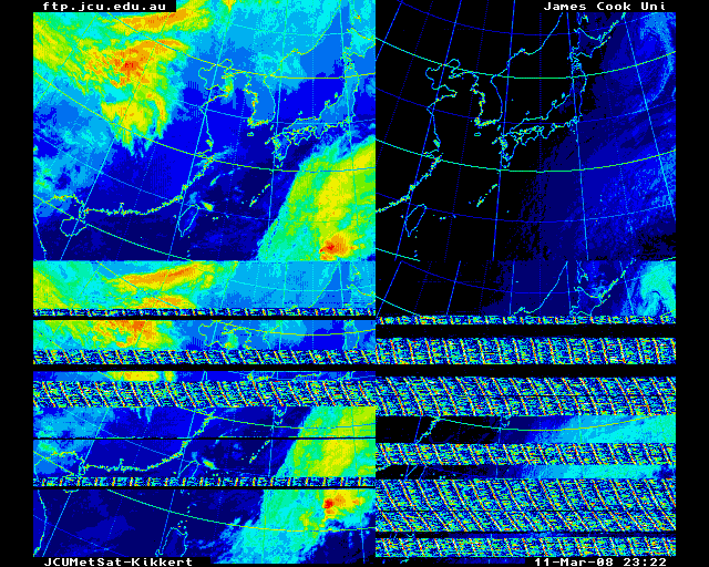
Low Resolution Picture of the Globe.
Click on the image for a bigger image
and an even still bigger image
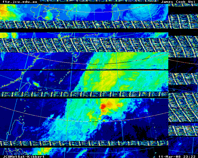
Low Resolution Picture of Australia.
Click on the image for a bigger image
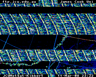
Low Resolution Picture of Queensland.
Special Interest Images
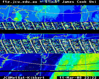
A current event.
Where to find more information:
The full archive of JCUMetSat images can be found at ftp://ftp.jcu.edu.au/JCUMetSat
Conditions of Use
The images in the ftp archive can be downloaded provided that:
1 If the images are published or re-distributed:
    I   The Department of Electrical and Computer Engineering at
        James Cook University, Townsville, Australia is to be acknowleged
        for receiving and processing the images.
    II  Permission from the Japanese Meteorological Agency is required
        and they are to be acknowleged for providing the raw data.
        (JMA Fax +81 3 3212 2453)
    III The images are not to be altered.
    IV  A copy of these conditions are placed in the ftp or www directory
        which contain the images and html links must point to these
        conditions in the case of www pages.

2 The Images are not to be sold.
About JCUMetSat
(This information is mainly applicable to the JCUMetSat ftp archive above)
The system is operated by Prof. C. J. Kikkert in the Department of Electrical and Computer Systems Engineering. Ethernet and Mainframe computer permitting, these pictures are automatically updated upon the reception of new pictures from the weather satellite. All the pictures are standard Amiga IFF files, also known as ILBM files. The latest images are also stored in Gif file format. Users wishing to view the pictures on other machines will need to convert the pictures using one of the standard conversion routines like pbmplus or alchemy. For more details see the viewers subdirectory, which also has an IBM-PC viewer in it. The pictures ending with "last" are the most recent pictures of a particular area. For Example auslast and globelast are the most recent pictures of Australia and the Globe. The most recent Globe pictures are stored in various resolutions, so that ftp users can view the high resolution picture and Phone users can view the low resolution picture to minimise cost. All the directories with picture names ending in "v" contain VGA size pastings. There are several Globe directories like globem, globev, globeh and so on. These directories contain globe pictures of different sizes and resolution. For example globev contains a VGA size ie 640x480 picture, globeh contains a 640x512 size picture, globem contains a 640x256 size picture and globef contains 1160x1198 size pictures. Typically the last 3 days worth of pictures are stored in each directory. The pictures in the Event directory are varied. If a Cyclone or Typhoon occurs, the Event directory may show these. If our logging machine is used to produce some special demonstration sequences, the Event directory will reflect these. This directory is often used for requested pictures. The pictures are received using an Amiga computer and the files stored here are standard Amiga IFF files, using 640x512, 640x256 or 320x256 pixels and 16 colours (PAL format), 640x480 pixels and 16 colours (VGA), or larger (1160x1198). The sector pictures use 752x800 pixels and 16 colours. In the Information directory you will also find three postscript files: A file WeatherViewAmiga.ps and the file WeatherViewIBMPC.ps are one page postscript file describing the Amiga and IBMPC versions of the JCUWeatherView software. Both the Amiga and the IBMPC software allows one to View these pictures either singly or as an animated sequence in black and white or in a false colour scheme. The animation speed can be up to 19 pictures per second on an A500/2000 or up to 57 pictures per second on an A3000 or A4000. Memory permitting up to 400 pictures can be shown in a single sequence on an Amiga 4000. PAL and NTSC versions are available. The speed of animation on an IBMPC will largely depend on the type of machine and the graphics card fitted. The IBMPC software does not yet permit cutting and pasting operations. The file JCUMetSat.ps is a 5 page postscript file describing the full JCUMetSat Weather Satellite Receiving System. This system is used to produce the pictures in this directory. The system will work with the European Meteosat as well as the American Goes satellites. Pal and NTSC versions of the software are available. In Australia several TV stations use JCUMetSat Receiving Systems to display pictures like these for their daily weather bulletins. These postscript files do contain some pictures, hence their size. Since the files are standard Amiga IFF files any Amiga graphics program can be used to view these pictures. Dpaint and AmigaVision can be used to produce rudimentary animated sequences. For those with other computers, the files viewpc.exe is a public domain IBM-PC IFF file viewer. This is in fact a demo version of our JCUWeatherView-PC software. A MacIntosh file converter, amiga viewer and information is also included in that directory
Sub-Directory
  ausm     640x256   pictures of Australia
  ausv     640x480   pictures of Australia VGA size.
  event    320x256   pictures of a current event such as Typhoon or Cyclone
                       often still aimed at the location of the last event.
  globem   640x256   pictures of the globe in medium resolution
  globev   640x480     ditto VGA size, GIF files.
  globehr  640x512     ditto high resolution.
  globef  1024x1024    ditto Full resolution.
  nausl    320x256   North Auastralia, (Northern Territory)
  neausl   320x256   NorthEast Australia, (Queensland).
  sausl    320x256   South Australia
  seausl   320x256   SouthEast Australia, (NSW and Victoria)
  wausl    230x256   West Australia, (West Australia)


Sector-a etc  752x800 the raw sector pictures, IFF files.
CalChart.iff  320x256 The mapping of picture colours to temperature.
schedule.iff  752x800 the latest transmission schedule (Manam)
The miscpics directory contains a variety of pictures such as JCU Crests for students to use in documents.
Please note that the logging is done using an Amiga2000 computer for this web page and an Amiga 3000 for the other web page. As a result the cutting and pasting takes about half an hour to complete. The same cutting and pasting takes less than 2 minutes on an Amiga 4000. In the future we may be able to ugrade. If you wish to obtain further information send your request including your postal addres to Prof. C. J. Kikkert, Department of Electrical and Computer Engineering James Cook University of North Queensland Townsville Australia 4811Fax 077-251348 int +61-77-251348, Phone 077-814259, 077-814299
This page maintained by
Keith.Kikkert@jcu.edu.au