./mhg_ob_g.htm��������������������������������������������������������������������������������������0000664�0017141�0017141�00000061136�15013527057�014564� 0����������������������������������������������������������������������������������������������������ustar �discmaster����������������������discmaster�������������������������������������������������������������������������������������������������������������������������������������������������������������������������������������������������������������
ESRI GRID Raster Dataset Model of Overburden Above the Mahogany Zone in the Piceance Basin, Colorado
ESRI GRID Raster Dataset Model of Overburden Above the Mahogany Zone in the Piceance Basin, Colorado
An ESRI GRID raster data model of the overburden material above the Mahogany Zone was needed to perform calculations in the Piceance Basin, Colorado as part of a 2009 National Oil Shale Assessment.
Purpose:
Increasing energy demand, changing economics, new technology, and geopolitical issues have spurred renewed interest in other energy alternatives such as oil shale, heavy oil, and tar sands. The USGS Energy Resources Program has previously conducted extensive field and geologic research on these commodities and is initiating an effort to inventory and make these important legacy information assets accessible to the public, land managers, and other decision-makers. In addition, the Energy Program is scoping the geologic, technical, economic, and environmental factors controlling the production and use of these energy sources and will provide recommendations for future research in order to meet the energy needs of the United States.
Time_Period_of_Content:
Time_Period_Information:
Single_Date/Time:
Calendar_Date: 2009
Currentness_Reference: publication date
Status:
Progress: Complete
Maintenance_and_Update_Frequency: As needed
Spatial_Domain:
Bounding_Coordinates:
West_Bounding_Coordinate: -108.775514
East_Bounding_Coordinate: -107.727222
North_Bounding_Coordinate: 40.190224
South_Bounding_Coordinate: 39.249306
Keywords:
Theme:
Theme_Keyword_Thesaurus: ISO 19115 Topic Category
Theme_Keyword: geoscientificInformation
Theme:
Theme_Keyword_Thesaurus: Gateway to the Earth draft 9 28-Jun-2002
Theme_Keyword: Oil shale resources
Theme_Keyword: Economic geology
Theme:
Theme_Keyword_Thesaurus: USGS Energy Resources Science Center Thesaurus
Theme_Keyword: Energy resources
Theme_Keyword: Oil shale
Theme_Keyword: Oil
Theme_Keyword: Resource assessment
Theme_Keyword: Earth science
Theme_Keyword: Natural resources
Theme_Keyword: U.S. Geological Survey
Theme_Keyword: USGS
Theme_Keyword: Geology
Theme_Keyword: Eocene Green River Formation
Theme_Keyword: Structure
Theme_Keyword: Mahogany ledge
Theme_Keyword: Mahogany
Theme_Keyword: Overburden
Place:
Place_Keyword: United States
Place_Keyword: Piceance Basin
Place_Keyword: CO
Place_Keyword: Colorado
Access_Constraints: none
Use_Constraints:
This dataset is appropriate for regional-scale analysis at scales of 1:100,000 or less.
Point_of_Contact:
Contact_Information:
Contact_Organization_Primary:
Contact_Organization: U.S. Geological Survey, Energy Resources Science Center
Browse_Graphic_File_Description: Thumbnail view of Piceance Basin
Browse_Graphic_File_Type: JPEG
Native_Data_Set_Environment:
Microsoft Windows XP Version 5.1 (Build 2600) Service Pack 3; ESRI ArcCatalog 9.3.1.3000
Data_Quality_Information:
Logical_Consistency_Report:
The accuracy of the data contained in this raster model is a reflection of the accuracy of the data contained in the original source maps, the scale of the source maps, the scale at which the original linework was digitized, and the interpolations and extrapolations of the source values during vector to raster conversion.
Completeness_Report:
The raster model contains cell values based on the thickness of overburden and variations (through interpolation and extrapolation) of those values above the Mahogany zone in the Piceance Basin, Colorado.
Positional_Accuracy:
Horizontal_Positional_Accuracy:
Horizontal_Positional_Accuracy_Report:
All raster models have been peer-reviewed and are found to be geologically reasonable and accurate.
Lineage:
Source_Information:
Source_Citation:
Citation_Information:
Originator: Hail, W. J.
Originator: Smith, M. C.
Publication_Date: 1994
Title:
Geologic map of the northern part of the Piceance Creek basin, northwestern Colorado
Geospatial_Data_Presentation_Form: map
Series_Information:
Series_Name: U.S. Geological Survey Miscellaneous Investigation Map
Source_Citation_Abbreviation: National Elevation Dataset (NED)
Source_Contribution: Elevation information.
Process_Step:
Process_Description:
The original paper source maps were scanned, registered, and rectified and the top of the Mahogany ledge outcrop and structure contour lines were digitized in ArcGIS v. 9.1. Gaps in coverage near Battlement Mesa were contoured by hand by staff geologist and transferred to the digital polyline file. The structure contour lines were converted to a point file containing elevation values for the top of the Mahogany zone. For the Mahogany outcrop line surface elevation values in feet were extracted from a Digital Elevation Model (DEM) to obtain elevation values for the Mahogany ledge. The two point files were merged to generate a surface model in ArcGIS by using the GeoStatistical Analyst's Radial Basis Function (RBF) contouring method. The RBF surface model was converted to an ESRI GRID. The Mahogany surface GRID was then subtracted from a DEM GRID using the ArcGIS Spatial Analyst Raster Calculator. The resultant GRID contains values of total overburden, in feet, above the Mahogany zone for each one-acre cell.
Process_Date: 2009
Process_Contact:
Contact_Information:
Contact_Organization_Primary:
Contact_Organization: U.S. Geological Survey, Energy Resources Science Center
Contact_Person: Tracey J. Mercier
Contact_Position: IT Specialist
Contact_Address:
Address_Type: mailing and physical address
Address:
U.S. Geological Survey, Box 25046, MS 939, Denver Federal Center
Although these data have been processed successfully on a computer system at the U.S. Geological Survey, no warranty expressed or implied is made regarding the display or utility of the data on any other system, or for general or scientific purposes, nor shall the act of distribution constitute any such warranty. The U.S. Geological Survey shall not be held liable for improper or incorrect use of the data described and/or contained herein. Any use of trade, product, or firm names is for descriptive purposes only and does not imply endorsement by the U.S. Government. Although this information product, for the most part, is in the public domain, it also contains copyrighted materials as noted in the text. Permission to reproduce copyrighted items for other than personal use must be secured from the copyright owner.
Standard_Order_Process:
Digital_Form:
Digital_Transfer_Information:
Format_Name: ESRI GRID
Format_Information_Content: Cell values of Mahogany zone overburden, in feet
The URL above links to a zipped file of spatial data used to calculate oil shale resources for the Piceance Basin, Colorado. The file contains all spatial data contained on disc 2 of DDS-69-Y.
Offline_Option:
Offline_Media: CD-ROM
Metadata_Reference_Information:
Metadata_Date: 20100624
Metadata_Contact:
Contact_Information:
Contact_Organization_Primary:
Contact_Organization: U.S. Geological Survey, Energy Resources Science Center
Contact_Person: Tracey J. Mercier
Contact_Position: IT Specialist
Contact_Address:
Address_Type: mailing and physical address
Address:
U.S. Geological Survey, Box 25046, MS 939, Denver Federal Center
City: Denver
State_or_Province: Colorado
Postal_Code: 80225
Country: USA
Contact_Voice_Telephone: 303 236 5088
Contact_Facsimile_Telephone: 303 236 0459
Contact_Electronic_Mail_Address: datamgt@usgs.gov
Contact_Instructions:
For inquiries regarding this document, please include the metadata contact person's name, dataset name, and publication series and number.
Metadata_Standard_Name: FGDC Content Standards for Digital Geospatial Metadata
Generated by mp version 2.9.6 on Thu Jun 24 09:04:11 2010
����������������������������������������������������������������������������������������������������������������������������������������������������������������������������������������������������������������������������������������������������������������������������������������������������������������������������������������������������������������������������������������������������������������������������������./piceance_nahcolite_zone_pol.htm�������������������������������������������������������������������0000664�0017141�0017141�00000053462�15013527057�020530� 0����������������������������������������������������������������������������������������������������ustar �discmaster����������������������discmaster�������������������������������������������������������������������������������������������������������������������������������������������������������������������������������������������������������������
Polygon File to Limit Nahcolite Resource Calculations in the Piceance Basin, Colorado
Polygon File to Limit Nahcolite Resource Calculations in the Piceance Basin, Colorado
A polygon file to delineate a nahcolite resource assessment area for eight oil shale zones in the Piceance Basin, Colorado was needed as part of a 2009 National Oil Shale and Nahcolite Assessment. The zones in descending order are: L-5, R-5, L-4, R-4, L-3, R-3, L-2, and R-2.
Purpose:
Increasing energy demand, changing economics, new technology, and geopolitical issues have spurred renewed interest in other energy alternatives such as oil shale, heavy oil, and tar sands. The USGS Energy Resources Program has previously conducted extensive field and geologic research on these commodities and is initiating an effort to inventory and make these important legacy information assets accessible to the public, land managers, and other decision-makers. In addition, the Energy Program is scoping the geologic, technical, economic, and environmental factors controlling the production and use of these energy sources and will provide recommendations for future research in order to meet the energy needs of the United States.
Time_Period_of_Content:
Time_Period_Information:
Single_Date/Time:
Calendar_Date: 2009
Currentness_Reference: publication date
Status:
Progress: Complete
Maintenance_and_Update_Frequency: As needed
Spatial_Domain:
Bounding_Coordinates:
West_Bounding_Coordinate: -108.483990
East_Bounding_Coordinate: -108.152621
North_Bounding_Coordinate: 40.091226
South_Bounding_Coordinate: 39.774973
Keywords:
Theme:
Theme_Keyword_Thesaurus: ISO 19115 Topic Category
Theme_Keyword: geoscientificInformation
Theme:
Theme_Keyword_Thesaurus: Gateway to the Earth draft 9 28-Jun-2002
Theme_Keyword: Oil shale resources
Theme_Keyword: Economic geology
Theme:
Theme_Keyword_Thesaurus: USGS Energy Resources Science Center Thesaurus
Theme_Keyword: Energy resources
Theme_Keyword: Oil shale
Theme_Keyword: Oil
Theme_Keyword: Resource assessment
Theme_Keyword: Earth science
Theme_Keyword: Natural resources
Theme_Keyword: U.S. Geological Survey
Theme_Keyword: USGS
Theme_Keyword: Geology
Theme_Keyword: Eocene Green River Formation
Theme_Keyword: outcrop
Theme_Keyword: Mahogany ledge
Theme_Keyword: Mahogany
Theme_Keyword: nahcolite
Place:
Place_Keyword: United States
Place_Keyword: Piceance Basin
Place_Keyword: CO
Place_Keyword: Colorado
Access_Constraints: none
Use_Constraints:
This dataset is appropriate for regional-scale analysis at scales of 1:100,000 or less.
Point_of_Contact:
Contact_Information:
Contact_Organization_Primary:
Contact_Organization: U.S. Geological Survey, Energy Resources Science Center
Browse_Graphic_File_Description: Thumbnail view of Piceance Basin
Browse_Graphic_File_Type: JPEG
Native_Data_Set_Environment:
Microsoft Windows XP Version 5.1 (Build 2600) Service Pack 3; ESRI ArcCatalog 9.3.1.3000
Data_Quality_Information:
Logical_Consistency_Report:
The accuracy of the data contained in this polygon file is a reflection of the accuracy of the data contained in the original source map, the scale of the source map, and the scale at which the linework was digitized.
Completeness_Report:
The polygon file contains linework to limit nahcolite resource calculations and delineate the boundaries of the nahcolite assessment area within the Piceance Basin, Colorado .
Positional_Accuracy:
Horizontal_Positional_Accuracy:
Horizontal_Positional_Accuracy_Report:
All polygon files have been peer-reviewed and are found to be geologically reasonable and accurate.
Lineage:
Source_Information:
Source_Citation:
Citation_Information:
Originator: Hail, W. J
Originator: Smith, M. C., 1994
Publication_Date: 1994
Title:
Geologic map of the northern part of the Piceance Creek basin, northwestern Colorado
Geospatial_Data_Presentation_Form: map
Series_Information:
Series_Name: U.S. Geological Survey Miscellaneous Investigation Map
Source_Contribution: outcrop line for the Mahogany ledge
Process_Step:
Process_Description:
A polygon to delineate a nahcolite resource assessment area was digitized onscreen by a staff geologist in ArcGIS v. 9.2. The polygon was intersected with the Mahogany Ledge outcrop linework in the northeastern part of the Piceance Basin to create a limiting nahcolite resource assessment polygon.
Process_Date: 2009
Process_Contact:
Contact_Information:
Contact_Organization_Primary:
Contact_Organization: U.S. Geological Survey, Energy Resources Science Center
Contact_Person: Tracey J. Mercier
Contact_Position: IT Specialist
Contact_Address:
Address_Type: mailing and physical address
Address:
U.S. Geological Survey, Box 25046, MS 939, Denver Federal Center
Although these data have been processed successfully on a computer system at the U.S. Geological Survey, no warranty expressed or implied is made regarding the display or utility of the data on any other system, or for general or scientific purposes, nor shall the act of distribution constitute any such warranty. The U.S. Geological Survey shall not be held liable for improper or incorrect use of the data described and/or contained herein. Any use of trade, product, or firm names is for descriptive purposes only and does not imply endorsement by the U.S. Government. Although this information product, for the most part, is in the public domain, it also contains copyrighted materials as noted in the text. Permission to reproduce copyrighted items for other than personal use must be secured from the copyright owner.
Standard_Order_Process:
Digital_Form:
Digital_Transfer_Information:
Format_Name: Shapefile
Format_Information_Content: nahcolite-bearing zone polygon within the Piceance Basin
The URL above links to a zipped file of spatial data used to calculate oil shale and nahcolite resources for the Piceance Basin, Colorado. The file contains all spatial data contained on disc 2 of DDS-69-Y.
Offline_Option:
Offline_Media: CD-ROM
Metadata_Reference_Information:
Metadata_Date: 20100624
Metadata_Contact:
Contact_Information:
Contact_Organization_Primary:
Contact_Organization: U.S. Geological Survey, Energy Resources Science Center
Contact_Person: Tracey J. Mercier
Contact_Position: IT Specialist
Contact_Address:
Address_Type: mailing and physical address
Address:
U.S. Geological Survey, Box 25046, MS 939, Denver Federal Center
City: Denver
State_or_Province: Colorado
Postal_Code: 80225
Country: USA
Contact_Voice_Telephone: 303 236 5088
Contact_Electronic_Mail_Address: datamgt@usgs.gov
Contact_Instructions:
For inquiries regarding this document, please include the metadata contact person's name, dataset name, and publication series and number.
Metadata_Standard_Name: FGDC Content Standards for Digital Geospatial Metadata
Generated by mp version 2.9.6 on Thu Jun 24 09:05:00 2010
��������������������������������������������������������������������������������������������������������������������������������������������������������������������������������������������������������������./all_niso.htm��������������������������������������������������������������������������������������0000664�0017141�0017141�00000060071�15013527057�014620� 0����������������������������������������������������������������������������������������������������ustar �discmaster����������������������discmaster�������������������������������������������������������������������������������������������������������������������������������������������������������������������������������������������������������������
ESRI GRID Raster Dataset Model of Nahcolite Resources in the Piceance Basin, Colorado
ESRI GRID Raster Dataset Model of Nahcolite Resources in the Piceance Basin, Colorado
ESRI GRID raster datasets were created to display and quantify nahcolite resources for eight oil shale zones in the Piceance Basin, Colorado as part of a 2009 National Oil Shale and Nahcolite Assessment. The zones in descending order are: L-5, R-5, L-4, R-4, L-3, R-3, L-2, and R-2. Each raster cell represents a one-acre square of the land surface and contains values for the isopach thickness, in feet, of the entire nahcolite-bearing interval. This GRID contains cell values for the total thickness, in feet, of all eight nahcolite zones combined (L-5 through R-2).
Purpose:
Increasing energy demand, changing economics, new technology, and geopolitical issues have spurred renewed interest in other energy alternatives such as oil shale, heavy oil, and tar sands. The USGS Energy Resources Program has previously conducted extensive field and geologic research on these commodities and is initiating an effort to inventory and make these important legacy information assets accessible to the public, land managers, and other decision-makers. In addition, the Energy Program is scoping the geologic, technical, economic, and environmental factors controlling the production and use of these energy sources and will provide recommendations for future research in order to meet the energy needs of the United States.
Time_Period_of_Content:
Time_Period_Information:
Single_Date/Time:
Calendar_Date: 2009
Currentness_Reference: publication date
Status:
Progress: Complete
Maintenance_and_Update_Frequency: As needed
Spatial_Domain:
Bounding_Coordinates:
West_Bounding_Coordinate: -108.775514
East_Bounding_Coordinate: -107.727222
North_Bounding_Coordinate: 40.190224
South_Bounding_Coordinate: 39.249306
Keywords:
Theme:
Theme_Keyword_Thesaurus: ISO 19115 Topic Category
Theme_Keyword: geoscientificInformation
Theme:
Theme_Keyword_Thesaurus: Gateway to the Earth draft 9 28-Jun-2002
Theme_Keyword: Oil shale resources
Theme_Keyword: Economic geology
Theme_Keyword: Nahcolite resources
Theme:
Theme_Keyword_Thesaurus: USGS Energy Resources Science Center Thesaurus
Theme_Keyword: Energy resources
Theme_Keyword: Oil shale
Theme_Keyword: Oil
Theme_Keyword: Resource assessment
Theme_Keyword: Earth science
Theme_Keyword: Natural resources
Theme_Keyword: U.S. Geological Survey
Theme_Keyword: USGS
Theme_Keyword: Geology
Theme_Keyword: Eocene Green River Formation
Theme_Keyword: Nahcolite
Theme_Keyword: Isopach
Theme_Keyword: Thickness
Place:
Place_Keyword: United States
Place_Keyword: Piceance Basin
Place_Keyword: CO
Place_Keyword: Colorado
Access_Constraints: none
Use_Constraints:
This dataset is appropriate for regional-scale analysis at scales of 1:100,000 or less.
Point_of_Contact:
Contact_Information:
Contact_Organization_Primary:
Contact_Organization: U.S. Geological Survey, Energy Resources Science Center
Browse_Graphic_File_Description: Thumbnail view of Piceance Basin
Browse_Graphic_File_Type: JPEG
Native_Data_Set_Environment:
Microsoft Windows XP Version 5.1 (Build 2600) Service Pack 3; ESRI ArcCatalog 9.3.1.3000
Data_Quality_Information:
Logical_Consistency_Report:
The accuracy of the data contained in this raster model is a reflection of the accuracy of the data contained in the original database, the calculations performed on those data, and the geologic interpretations contained therein.
Completeness_Report:
The raster model contains cell values based on values in the original database and variations (through interpolation and extrapolation) of those values for the thickness of the entire nahcolite-bearing interval of eight oil shale zones (L-5 through R-2).
Positional_Accuracy:
Horizontal_Positional_Accuracy:
Horizontal_Positional_Accuracy_Report:
All raster models have been peer-reviewed and are found to be geologically reasonable and accurate.
Lineage:
Source_Information:
Source_Citation:
Citation_Information:
Originator: Tracey J. Mercier
Publication_Date: 2009
Title: Piceance_Nahcolite_Holes.shp
Geospatial_Data_Presentation_Form: vector digital data
Series_Information:
Series_Name: U.S. Geological Survey Digital Data Series
Issue_Identification: DDS-??-?
Publication_Information:
Publication_Place: Denver, Colorado
Publisher: U.S. Geological Survey
Larger_Work_Citation:
Citation_Information:
Originator: Tracey J. Mercier
Publication_Date: 2009
Title:
The GIS Project for the Geologic Assessment of In-Place Oil Shale Resources of the Piceance Basin, Colorado
Series_Information:
Series_Name: U.S. Geological Survey Digital Data Series
Values and variations of the isopach thickness, in feet, of eight oil shale zones combined (L-5 through R-2).
Process_Step:
Process_Description:
Values from boreholes for variations of the thickness of the entire nahcolite-bearing interval for eight oil shale zones combined were contained within the ESRI shapefile "Piceance_Nahcolite_Holes.shp." The shapefile was accessed in ArcGIS v. 9.2. The ESRI extension GeoStatistical Analyst (GA) was used to model each parameter using a multiquadric Radial Basis Function (RBF), with fifteen neighbors in 10 sectors. Each GA model was exported to an ESRI GRID format using an analysis mask which defined the nahcolite-bearing zone for eight oil shale zones (L-5 through R-2) with a 63.615 meter (1 square acre) cell size and one point per cell for block interpolation.
Process_Date: 2009
Process_Contact:
Contact_Information:
Contact_Organization_Primary:
Contact_Organization: U.S. Geological Survey, Energy Resources Science Center
Contact_Person: Tracey J. Mercier
Contact_Position: IT Specialist
Contact_Address:
Address_Type: mailing and physical address
Address:
U.S. Geological Survey, Box 25046, MS 939, Denver Federal Center
Although these data have been processed successfully on a computer system at the U.S. Geological Survey, no warranty expressed or implied is made regarding the display or utility of the data on any other system, or for general or scientific purposes, nor shall the act of distribution constitute any such warranty. The U.S. Geological Survey shall not be held liable for improper or incorrect use of the data described and/or contained herein. Any use of trade, product, or firm names is for descriptive purposes only and does not imply endorsement by the U.S. Government. Although this information product, for the most part, is in the public domain, it also contains copyrighted materials as noted in the text. Permission to reproduce copyrighted items for other than personal use must be secured from the copyright owner.
Standard_Order_Process:
Digital_Form:
Digital_Transfer_Information:
Format_Name: ESRI GRID
Format_Information_Content:
Cell values of the thickness, in feet, of entire nahcolite-bearing interval
The URL above links to a zipped file of spatial data used to calculate oil shale and nahcolite resources for the Piceance Basin, Colorado. The file contains all spatial data contained on disc 2 of DDS-69-Y.
Offline_Option:
Offline_Media: CD-ROM
Metadata_Reference_Information:
Metadata_Date: 20100624
Metadata_Contact:
Contact_Information:
Contact_Organization_Primary:
Contact_Organization: U.S. Geological Survey, Energy Resources Science Center
Contact_Person: Tracey J. Mercier
Contact_Position: IT Specialist
Contact_Address:
Address_Type: mailing and physical address
Address:
U.S. Geological Survey, Box 25046, MS 939, Denver Federal Center
City: Denver
State_or_Province: Colorado
Postal_Code: 80225
Country: USA
Contact_Voice_Telephone: 303 236 5088
Contact_Electronic_Mail_Address: datamgt@usgs.gov
Contact_Instructions:
For inquiries regarding this document, please include the metadata contact person's name, dataset name, and publication series and number.
Metadata_Standard_Name: FGDC Content Standards for Digital Geospatial Metadata
Generated by mp version 2.9.6 on Thu Jun 24 09:03:52 2010
�����������������������������������������������������������������������������������������������������������������������������������������������������������������������������������������������������������������������������������������������������������������������������������������������������������������������������������������������������������������������������������������������������������������������������������������������������������������������./all_n.htm�����������������������������������������������������������������������������������������0000664�0017141�0017141�00000057376�15013527057�014123� 0����������������������������������������������������������������������������������������������������ustar �discmaster����������������������discmaster�������������������������������������������������������������������������������������������������������������������������������������������������������������������������������������������������������������
ESRI GRID Raster Dataset Model of Nahcolite Resources in the Piceance Basin, Colorado
ESRI GRID Raster Dataset Model of Nahcolite Resources in the Piceance Basin, Colorado
ESRI GRID raster datasets were created to display and quantify nahcolite resources for eight oil shale zones in the Piceance Basin, Colorado as part of a 2009 National Oil Shale and Nahcolite Assessment. The zones in descending order are: L-5, R-5, L-4, R-4, L-3, R-3, L-2, and R-2. Each raster cell represents a one-acre square of the land surface and contains values for nahcolite tonnage. The gridnames follow the naming convention *_n, where "*" can be replaced by the name of the oil shale zone.
Purpose:
Increasing energy demand, changing economics, new technology, and geopolitical issues have spurred renewed interest in other energy alternatives such as oil shale, heavy oil, and tar sands. The USGS Energy Resources Program has previously conducted extensive field and geologic research on these commodities and is initiating an effort to inventory and make these important legacy information assets accessible to the public, land managers, and other decision-makers. In addition, the Energy Program is scoping the geologic, technical, economic, and environmental factors controlling the production and use of these energy sources and will provide recommendations for future research in order to meet the energy needs of the United States.
Time_Period_of_Content:
Time_Period_Information:
Single_Date/Time:
Calendar_Date: 2009
Currentness_Reference: publication date
Status:
Progress: Complete
Maintenance_and_Update_Frequency: As needed
Spatial_Domain:
Bounding_Coordinates:
West_Bounding_Coordinate: -108.775514
East_Bounding_Coordinate: -107.727222
North_Bounding_Coordinate: 40.190224
South_Bounding_Coordinate: 39.249306
Keywords:
Theme:
Theme_Keyword_Thesaurus: ISO 19115 Topic Category
Theme_Keyword: geoscientificInformation
Theme:
Theme_Keyword_Thesaurus: Gateway to the Earth draft 9 28-Jun-2002
Theme_Keyword: Oil shale resources
Theme_Keyword: Economic geology
Theme_Keyword: Nahcolite resources
Theme:
Theme_Keyword_Thesaurus: USGS Energy Resources Science Center Thesaurus
Theme_Keyword: Energy resources
Theme_Keyword: Oil shale
Theme_Keyword: Oil
Theme_Keyword: Resource assessment
Theme_Keyword: Earth science
Theme_Keyword: Natural resources
Theme_Keyword: U.S. Geological Survey
Theme_Keyword: USGS
Theme_Keyword: Geology
Theme_Keyword: Eocene Green River Formation
Theme_Keyword: Nahcolite
Place:
Place_Keyword: United States
Place_Keyword: Piceance Basin
Place_Keyword: CO
Place_Keyword: Colorado
Access_Constraints: none
Use_Constraints:
This dataset is appropriate for regional-scale analysis at scales of 1:100,000 or less.
Point_of_Contact:
Contact_Information:
Contact_Organization_Primary:
Contact_Organization: U.S. Geological Survey, Energy Resources Science Center
Browse_Graphic_File_Description: Thumbnail view of Piceance Basin
Browse_Graphic_File_Type: JPEG
Native_Data_Set_Environment:
Microsoft Windows XP Version 5.1 (Build 2600) Service Pack 3; ESRI ArcCatalog 9.3.1.3000
Data_Quality_Information:
Logical_Consistency_Report:
The accuracy of the data contained in this raster model is a reflection of the accuracy of the data contained in the original database, the calculations performed on those data, and the geologic interpretations contained therein.
Completeness_Report:
The raster model containes cell values based on values in the original database and variations (through interpolation and extrapolation) of those values for average weight percent nahcolite for a specific oil shale zone.
Positional_Accuracy:
Horizontal_Positional_Accuracy:
Horizontal_Positional_Accuracy_Report:
All raster models have been peer-reviewed and are found to be geologically reasonable and accurate.
Lineage:
Source_Information:
Source_Citation:
Citation_Information:
Originator: Tracey J. Mercier
Publication_Date: 2009
Title: Piceance_Nahcolite_Holes.shp
Geospatial_Data_Presentation_Form: vector digital data
Series_Information:
Series_Name: U.S. Geological Survey Digital Data Series
Issue_Identification: DDS-??-?
Publication_Information:
Publication_Place: Denver, Colorado
Publisher: U.S. Geological Survey
Larger_Work_Citation:
Citation_Information:
Originator: Tracey J. Mercier
Originator: Gregory L. Gunther
Originator: Christopher C. Skinner
Publication_Date: 2009
Title:
The GIS Project for the Geologic Assessment of In-Place Oil Shale Resources of the Piceance Basin, Colorado
Series_Information:
Series_Name: U.S. Geological Survey Digital Data Series
Values and variations of nahcolite in weight percent for eight oil shale zones.
Process_Step:
Process_Description:
Values from boreholes for variations of nahcolite tonnage per acre for a specific oil shale zone were contained within the ESRI shapefile "Piceance_Nahcolite_Holes.shp." The shapefile was accessed in ArcGIS v. 9.2. The ESRI extension GeoStatistical Analyst (GA) was used to model each parameter using a multiquadric Radial Basis Function (RBF), with fifteen neighbors in 10 sectors. Each GA model was exported to an ESRI GRID format using an analysis mask which defined the nahcolite-bearing zone for each oil shale zone with a 63.615 meter (1 square acre) cell size and one point per cell for block interpolation.
Process_Date: 2009
Process_Contact:
Contact_Information:
Contact_Organization_Primary:
Contact_Organization: U.S. Geological Survey, Energy Resources Science Center
Contact_Person: Tracey J. Mercier
Contact_Position: IT Specialist
Contact_Address:
Address_Type: mailing and physical address
Address:
U.S. Geological Survey, Box 25046, MS 939, Denver Federal Center
Although these data have been processed successfully on a computer system at the U.S. Geological Survey, no warranty expressed or implied is made regarding the display or utility of the data on any other system, or for general or scientific purposes, nor shall the act of distribution constitute any such warranty. The U.S. Geological Survey shall not be held liable for improper or incorrect use of the data described and/or contained herein. Any use of trade, product, or firm names is for descriptive purposes only and does not imply endorsement by the U.S. Government. Although this information product, for the most part, is in the public domain, it also contains copyrighted materials as noted in the text. Permission to reproduce copyrighted items for other than personal use must be secured from the copyright owner.
Standard_Order_Process:
Digital_Form:
Digital_Transfer_Information:
Format_Name: ESRI GRID
Format_Information_Content: Cell values of nahcolite resources in average weight percent
The URL above links to a zipped file of spatial data used to calculate oil shale and nahcolite resources for the Piceance Basin, Colorado. The file contains all spatial data contained on disc 2 of DDS-69-Y.
Offline_Option:
Offline_Media: CD-ROM
Metadata_Reference_Information:
Metadata_Date: 20100624
Metadata_Contact:
Contact_Information:
Contact_Organization_Primary:
Contact_Organization: U.S. Geological Survey, Energy Resources Science Center
Contact_Person: Tracey J. Mercier
Contact_Position: IT Specialist
Contact_Address:
Address_Type: mailing and physical address
Address:
U.S. Geological Survey, Box 25046, MS 939, Denver Federal Center
City: Denver
State_or_Province: Colorado
Postal_Code: 80225
Country: USA
Contact_Voice_Telephone: 303 236 5088
Contact_Electronic_Mail_Address: datamgt@usgs.gov
Contact_Instructions:
For inquiries regarding this document, please include the metadata contact person's name, dataset name, and publication series and number.
Metadata_Standard_Name: FGDC Content Standards for Digital Geospatial Metadata
Generated by mp version 2.9.6 on Thu Jun 24 09:03:40 2010
������������������������������������������������������������������������������������������������������������������������������������������������������������������������������������������������������������������������������������������������������������������./piceance_nahcolite_holes.htm����������������������������������������������������������������������0000664�0017141�0017141�00000074576�15013527057�020026� 0����������������������������������������������������������������������������������������������������ustar �discmaster����������������������discmaster�������������������������������������������������������������������������������������������������������������������������������������������������������������������������������������������������������������
Oil Shale Core Holes Containing Nahcolite in the State of Colorado
Oil Shale Core Holes Containing Nahcolite in the State of Colorado
This file contains points that describe locations of oil shale core holes that contain nahcolite in the state of Colorado and is available as an ESRI shapefile, Google Earth KMZ file, and ASCII text file.
Purpose:
Increasing energy demand, changing economics, new technology, and geopolitical issues have spurred renewed interest in other energy alternatives such as oil shale, heavy oil, and tar sands. The USGS Energy Resources Program has previously conducted extensive field and geologic research on these commodities and is initiating an effort to inventory and make these important legacy information assets accessible to the public, land managers, and other decision-makers. In addition, the Energy Program is scoping the geologic, technical, economic, and environmental factors controlling the production and use of these energy sources and will provide recommendations for future research in order to meet the energy needs of the United States.
Time_Period_of_Content:
Time_Period_Information:
Single_Date/Time:
Calendar_Date: 2009
Currentness_Reference: publication date
Status:
Progress: Complete
Maintenance_and_Update_Frequency: As needed
Spatial_Domain:
Bounding_Coordinates:
West_Bounding_Coordinate: -108.544556
East_Bounding_Coordinate: -108.121289
North_Bounding_Coordinate: 40.087312
South_Bounding_Coordinate: 39.759728
Keywords:
Theme:
Theme_Keyword_Thesaurus: ArcIMS Metadata Server Theme Codes
Theme_Keyword: geoscientificInformation
Theme:
Theme_Keyword_Thesaurus: Gateway to the Earth draft 9 28-Jun-2002
Theme_Keyword: Oil shale resources
Theme_Keyword: Economic geology
Theme:
Theme_Keyword_Thesaurus: USGS Energy Resources Science Center Thesaurus
Theme_Keyword: Energy resources
Theme_Keyword: Oil shale
Theme_Keyword: Oil
Theme_Keyword: Resource assessment
Theme_Keyword: Earth science
Theme_Keyword: Natural resources
Theme_Keyword: U.S. Geological Survey
Theme_Keyword: USGS
Theme_Keyword: Geology
Theme_Keyword: Eocene Green River Formation
Theme_Keyword: Nahcolite
Place:
Place_Keyword: United States
Place_Keyword: Piceance Basin
Place_Keyword: CO
Place_Keyword: Colorado
Access_Constraints: none
Use_Constraints:
This dataset is appropriate for regional-scale analysis. Caution should be used as there may be inherent errors in the locations of these legacy data.
Point_of_Contact:
Contact_Information:
Contact_Organization_Primary:
Contact_Organization: U.S. Geological Survey, Energy Resources Science Center
Browse_Graphic_File_Description: Thumbnail view of Piceance Basin
Browse_Graphic_File_Type: JPEG
Native_Data_Set_Environment:
Microsoft Windows XP Version 5.1 (Build 2600) Service Pack 3; ESRI ArcCatalog 9.3.1.3000
Data_Quality_Information:
Logical_Consistency_Report:
The accuracy of the data contained in this shapefile is a reflection of the accuracy of the data contained in the original database. Every effort was made to maintain consistency and locate core holes according to their original descriptions.
Completeness_Report:
This point shapefile contains locations for all records that contained sufficient location information in the source tops file.
Positional_Accuracy:
Horizontal_Positional_Accuracy:
Horizontal_Positional_Accuracy_Report:
All point locations have been peer-reviewed and are found to be accurate.
Lineage:
Source_Information:
Source_Citation:
Citation_Information:
Originator: John R. Dyni
Originator: Ronald C. Johnson
Publication_Date: 2009
Publication_Time: Unknown
Title: Colorado Boreholes and Tops.xls
Geospatial_Data_Presentation_Form: spreadsheet
Type_of_Source_Media: Microsoft Excel spreadsheet
Source_Time_Period_of_Content:
Time_Period_Information:
Single_Date/Time:
Calendar_Date: 2009
Source_Currentness_Reference: publication date
Source_Contribution:
Locations of core holes, including latitude & longitude coordinates, township, range, section(PLSS), and footage measurements from section corners.
Process_Step:
Process_Description:
The majority of the locations were digitized in ArcGIS v. 9.1 based on footage measurements north, south, east, and west of PLSS section corners contained in the original database. A custom tool which combined the distance and sketch tools in ArcEditor was used to measure and place points. Source PLSS files used for spotting locations were obtained from Colorado BLM and projected to North American Datum 27 (NAD27). Where footage measurements were not available, the location was digitized in the center of the 1/4-1/4 section, 1/4 section, or the center of the section. In short, the best location data available in the original database was used.
Process_Date: 2007
Process_Contact:
Contact_Information:
Contact_Organization_Primary:
Contact_Organization: U.S. Geological Survey, Energy Resources Science Center
Contact_Person: Tracey J. Mercier
Contact_Position: IT Specialist
Contact_Address:
Address_Type: mailing and physical address
Address:
U.S. Geological Survey, Box 25046, MS 939, Denver Federal Center
Although these data have been processed successfully on a computer system at the U.S. Geological Survey, no warranty expressed or implied is made regarding the display or utility of the data on any other system, or for general or scientific purposes, nor shall the act of distribution constitute any such warranty. The U.S. Geological Survey shall not be held liable for improper or incorrect use of the data described and/or contained herein. Any use of trade, product, or firm names is for descriptive purposes only and does not imply endorsement by the U.S. Government. Although this information product, for the most part, is in the public domain, it also contains copyrighted materials as noted in the text. Permission to reproduce copyrighted items for other than personal use must be secured from the copyright owner.
The URL above links to a zipped file of spatial data used to calculate oil shale and nahcolite resources for the Piceance Basin, Colorado. The file contains all spatial data contained on disc 2 of DDS-69-Y.
Offline_Option:
Offline_Media: CD-ROM
Digital_Form:
Digital_Transfer_Information:
Format_Name: Google Earth KMZ
Format_Version_Number: KML 2.2
Format_Specification: Google Earth KMZ (Keyhole Markup Language, zipped) layer file
Generated by mp version 2.9.6 on Thu Jun 24 09:04:55 2010
����������������������������������������������������������������������������������������������������������������������������������./mhg_ob_t.htm��������������������������������������������������������������������������������������0000664�0017141�0017141�00000063214�15013527057�014600� 0����������������������������������������������������������������������������������������������������ustar �discmaster����������������������discmaster�������������������������������������������������������������������������������������������������������������������������������������������������������������������������������������������������������������
ESRI TIN Dataset Model of Overburden Above the Mahogany Zone in the Piceance Basin, Colorado
ESRI TIN Dataset Model of Overburden Above the Mahogany Zone in the Piceance Basin, Colorado
An ESRI TIN data model of the overburden material above the Mahogany Zone was needed to perform calculations in the Piceance Basin, Colorado as part of a 2009 National Oil Shale Assessment.
Purpose:
Increasing energy demand, changing economics, new technology, and geopolitical issues have spurred renewed interest in other energy alternatives such as oil shale, heavy oil, and tar sands. The USGS Energy Resources Program has previously conducted extensive field and geologic research on these commodities and is initiating an effort to inventory and make these important legacy information assets accessible to the public, land managers, and other decision-makers. In addition, the Energy Program is scoping the geologic, technical, economic, and environmental factors controlling the production and use of these energy sources and will provide recommendations for future research in order to meet the energy needs of the United States.
Time_Period_of_Content:
Time_Period_Information:
Single_Date/Time:
Calendar_Date: 2009
Currentness_Reference: publication date
Status:
Progress: Complete
Maintenance_and_Update_Frequency: As needed
Spatial_Domain:
Bounding_Coordinates:
West_Bounding_Coordinate: -108.751346
East_Bounding_Coordinate: -107.752052
North_Bounding_Coordinate: 40.166272
South_Bounding_Coordinate: 39.273471
Keywords:
Theme:
Theme_Keyword_Thesaurus: ISO 19115 Topic Category
Theme_Keyword: geoscientificInformation
Theme:
Theme_Keyword_Thesaurus: Gateway to the Earth draft 9 28-Jun-2002
Theme_Keyword: Oil shale resources
Theme_Keyword: Economic geology
Theme:
Theme_Keyword_Thesaurus: USGS Energy Resources Science Center Thesaurus
Theme_Keyword: Energy resources
Theme_Keyword: Oil shale
Theme_Keyword: Oil
Theme_Keyword: Resource assessment
Theme_Keyword: Earth science
Theme_Keyword: Natural resources
Theme_Keyword: U.S. Geological Survey
Theme_Keyword: USGS
Theme_Keyword: Geology
Theme_Keyword: Eocene Green River Formation
Theme_Keyword: Structure
Theme_Keyword: Mahogany ledge
Theme_Keyword: Mahogany
Theme_Keyword: Overburden
Place:
Place_Keyword: United States
Place_Keyword: Piceance Basin
Place_Keyword: CO
Place_Keyword: Colorado
Access_Constraints: none
Use_Constraints:
This dataset is appropriate for regional-scale analysis at scales of 1:100,000 or less.
Point_of_Contact:
Contact_Information:
Contact_Organization_Primary:
Contact_Organization: U.S. Geological Survey, Energy Resources Science Center
Browse_Graphic_File_Description: Thumbnail view of Piceance Basin
Browse_Graphic_File_Type: JPEG
Native_Data_Set_Environment:
Microsoft Windows XP Version 5.1 (Build 2600) Service Pack 3; ESRI ArcCatalog 9.3.1.3000
Data_Quality_Information:
Logical_Consistency_Report:
The accuracy of the data contained in this TIN model is a reflection of the accuracy of the data contained in the original source maps, the scale of the source maps, the scale at which the original linework was digitized, and the interpolations and extrapolations of the source values during vector to raster conversion.
Completeness_Report:
The TIN model contains node values based on the thickness of overburden and variations (through interpolation and extrapolation) of those values above the Mahogany zone in the Piceance Basin, Colorado.
Positional_Accuracy:
Horizontal_Positional_Accuracy:
Horizontal_Positional_Accuracy_Report:
All TIN models have been peer-reviewed and are found to be geologically reasonable and accurate.
Lineage:
Source_Information:
Source_Citation:
Citation_Information:
Originator: Hail, W. J.
Originator: Smith, M. C.
Publication_Date: 1994
Title:
Geologic map of the northern part of the Piceance Creek basin, northwestern Colorado
Geospatial_Data_Presentation_Form: map
Series_Information:
Series_Name: U.S. Geological Survey Miscellaneous Investigation Map
Source_Citation_Abbreviation: National Elevation Dataset (NED)
Source_Contribution: Elevation information.
Process_Step:
Process_Description:
The original paper source maps were scanned, registered, and rectified and the top of the Mahogany ledge outcrop and structure contour lines were digitized in ArcGIS v. 9.1. Gaps in coverage near Battlement Mesa were contoured by hand by staff geologist and transferred to the digital polyline file. The structure contour lines were converted to a point file containing elevation values for the top of the Mahogany zone. For the Mahogany outcrop line surface elevation values in feet were extracted from a Digital Elevation Model (DEM) to obtain elevation values for the Mahogany ledge. The two point files were merged to generate a surface model in ArcGIS by using the GeoStatistical Analyst's Radial Basis Function (RBF) contouring method. The RBF surface model was converted to an ESRI GRID. The Mahogany surface GRID was then subtracted from a DEM GRID using the ArcGIS Spatial Analyst Raster Calculator. The resultant GRID contains values of total overburden, in feet, above the Mahogany zone for each one-acre cell. The resultant overburden GRID was converted to a TIN using the Mahogany outcrop as a hard clip line.
Process_Date: 2009
Process_Contact:
Contact_Information:
Contact_Organization_Primary:
Contact_Organization: U.S. Geological Survey, Energy Resources Science Center
Contact_Person: Tracey J. Mercier
Contact_Position: IT Specialist
Contact_Address:
Address_Type: mailing and physical address
Address:
U.S. Geological Survey, Box 25046, MS 939, Denver Federal Center
Although these data have been processed successfully on a computer system at the U.S. Geological Survey, no warranty expressed or implied is made regarding the display or utility of the data on any other system, or for general or scientific purposes, nor shall the act of distribution constitute any such warranty. The U.S. Geological Survey shall not be held liable for improper or incorrect use of the data described and/or contained herein. Any use of trade, product, or firm names is for descriptive purposes only and does not imply endorsement by the U.S. Government. Although this information product, for the most part, is in the public domain, it also contains copyrighted materials as noted in the text. Permission to reproduce copyrighted items for other than personal use must be secured from the copyright owner.
Standard_Order_Process:
Digital_Form:
Digital_Transfer_Information:
Format_Name: ESRI TIN
Format_Information_Content: Values of Mahogany zone overburden, in feet
The URL above links to a zipped file of spatial data used to calculate oil shale resources for the Piceance Basin, Colorado. The file contains all spatial data contained on disc 2 of DDS-69-Y.
Offline_Option:
Offline_Media: CD-ROM
Metadata_Reference_Information:
Metadata_Date: 20100624
Metadata_Contact:
Contact_Information:
Contact_Organization_Primary:
Contact_Organization: U.S. Geological Survey, Energy Resources Science Center
Contact_Person: Tracey J. Mercier
Contact_Position: IT Specialist
Contact_Address:
Address_Type: mailing and physical address
Address:
U.S. Geological Survey, Box 25046, MS 939, Denver Federal Center
City: Denver
State_or_Province: Colorado
Postal_Code: 80225
Country: USA
Contact_Voice_Telephone: 303 236 5088
Contact_Facsimile_Telephone: 303 236 0459
Contact_Electronic_Mail_Address: datamgt@usgs.gov
Contact_Instructions:
For inquiries regarding this document, please include the metadata contact person's name, dataset name, and publication series and number.
Metadata_Standard_Name: FGDC Content Standards for Digital Geospatial Metadata
Generated by mp version 2.9.6 on Thu Jun 24 09:05:42 2010
������������������������������������������������������������������������������������������������������������������������������������������������������������������������������������������������������������������������������������������������������������������������������������������������������������������������������������������������������������������������������������./mhg_str.htm���������������������������������������������������������������������������������������0000664�0017141�0017141�00000057677�15013527057�014505� 0����������������������������������������������������������������������������������������������������ustar �discmaster����������������������discmaster�������������������������������������������������������������������������������������������������������������������������������������������������������������������������������������������������������������
Mahogany Ledge Digital Structure Contour Lines of the Piceance Basin, Colorado
Mahogany Ledge Digital Structure Contour Lines of the Piceance Basin, Colorado
The Mahogany ledge structure contour lines were needed to perform overburden calculations in the Piceance Basin, Colorado as part of a 2009 National Oil Shale Assessment.
Purpose:
Increasing energy demand, changing economics, new technology, and geopolitical issues have spurred renewed interest in other energy alternatives such as oil shale, heavy oil, and tar sands. The USGS Energy Resources Program has previously conducted extensive field and geologic research on these commodities and is initiating an effort to inventory and make these important legacy information assets accessible to the public, land managers, and other decision-makers. In addition, the Energy Program is scoping the geologic, technical, economic, and environmental factors controlling the production and use of these energy sources and will provide recommendations for future research in order to meet the energy needs of the United States.
Time_Period_of_Content:
Time_Period_Information:
Single_Date/Time:
Calendar_Date: 2009
Currentness_Reference: publication date
Status:
Progress: Complete
Maintenance_and_Update_Frequency: As needed
Spatial_Domain:
Bounding_Coordinates:
West_Bounding_Coordinate: -108.751526
East_Bounding_Coordinate: -107.739543
North_Bounding_Coordinate: 40.169942
South_Bounding_Coordinate: 39.266858
Keywords:
Theme:
Theme_Keyword_Thesaurus: ISO 19115 Topic Category
Theme_Keyword: geoscientificInformation
Theme:
Theme_Keyword_Thesaurus: Gateway to the Earth draft 9 28-Jun-2002
Theme_Keyword: Oil shale resources
Theme_Keyword: Economic geology
Theme:
Theme_Keyword_Thesaurus: USGS Energy Resources Science Center Thesaurus
Theme_Keyword: Energy resources
Theme_Keyword: Oil shale
Theme_Keyword: Oil
Theme_Keyword: Resource assessment
Theme_Keyword: Earth science
Theme_Keyword: Natural resources
Theme_Keyword: U.S. Geological Survey
Theme_Keyword: USGS
Theme_Keyword: Geology
Theme_Keyword: Eocene Green River Formation
Theme_Keyword: structure
Theme_Keyword: Mahogany ledge
Theme_Keyword: Mahogany
Place:
Place_Keyword: United States
Place_Keyword: Piceance Basin
Place_Keyword: CO
Place_Keyword: Colorado
Access_Constraints: none
Use_Constraints:
This dataset is appropriate for regional-scale analysis at scales of 1:100,000 or less.
Point_of_Contact:
Contact_Information:
Contact_Organization_Primary:
Contact_Organization: U.S. Geological Survey, Energy Resources Science Center
Browse_Graphic_File_Description: Thumbnail view of Piceance Basin
Browse_Graphic_File_Type: JPEG
Native_Data_Set_Environment:
Microsoft Windows XP Version 5.1 (Build 2600) Service Pack 3; ESRI ArcCatalog 9.3.1.3000
Data_Quality_Information:
Logical_Consistency_Report:
The accuracy of the data contained in this polyline file is a reflection of the accuracy of the data contained in the original source maps, the scale of the source maps, and the scale at which the linework was digitized.
Completeness_Report:
The polyline file contains structure contour lines drawn on top of the Mahogany ledge in the Piceance Basin, Colorado. Structure contour lines in the subsurface are drawn on top of the Mahogany zone.
Positional_Accuracy:
Horizontal_Positional_Accuracy:
Horizontal_Positional_Accuracy_Report:
All polyline files have been peer-reviewed and are found to be geologically reasonable and accurate.
Lineage:
Source_Information:
Source_Citation:
Citation_Information:
Originator: Hail, W. J
Originator: Smith, M. C., 1994
Publication_Date: 1994
Title:
Geologic map of the northern part of the Piceance Creek basin, northwestern Colorado
Geospatial_Data_Presentation_Form: map
Series_Information:
Series_Name: U.S. Geological Survey Miscellaneous Investigation Map
Source_Contribution: structure contour lines for the Mahogany ledge or zone
Process_Step:
Process_Description:
The original paper source maps were scanned, registered, and rectified and the top of the Mahogany ledge structure contour lines were digitized in ArcGIS v. 9.1. Gaps in coverage near Battlement Mesa were contoured by hand by staff geologist and transferred to the digital polyline file.
Process_Date: 2009
Process_Contact:
Contact_Information:
Contact_Organization_Primary:
Contact_Organization: U.S. Geological Survey, Energy Resources Science Center
Contact_Person: Tracey J. Mercier
Contact_Position: IT Specialist
Contact_Address:
Address_Type: mailing and physical address
Address:
U.S. Geological Survey, Box 25046, MS 939, Denver Federal Center
Although these data have been processed successfully on a computer system at the U.S. Geological Survey, no warranty expressed or implied is made regarding the display or utility of the data on any other system, or for general or scientific purposes, nor shall the act of distribution constitute any such warranty. The U.S. Geological Survey shall not be held liable for improper or incorrect use of the data described and/or contained herein. Any use of trade, product, or firm names is for descriptive purposes only and does not imply endorsement by the U.S. Government. Although this information product, for the most part, is in the public domain, it also contains copyrighted materials as noted in the text. Permission to reproduce copyrighted items for other than personal use must be secured from the copyright owner.
Standard_Order_Process:
Digital_Form:
Digital_Transfer_Information:
Format_Name: Shapefile
Format_Information_Content: Mahogany ledge digital structure contour lines
The URL above links to a zipped file of spatial data used to calculate oil shale resources for the Piceance Basin, Colorado. The file contains all spatial data contained on disc 2 of DDS-69-Y.
Offline_Option:
Offline_Media: CD-ROM
Metadata_Reference_Information:
Metadata_Date: 20100624
Metadata_Contact:
Contact_Information:
Contact_Organization_Primary:
Contact_Organization: U.S. Geological Survey, Energy Resources Science Center
Contact_Person: Tracey J. Mercier
Contact_Position: IT Specialist
Contact_Address:
Address_Type: mailing and physical address
Address:
U.S. Geological Survey, Box 25046, MS 939, Denver Federal Center
City: Denver
State_or_Province: Colorado
Postal_Code: 80225
Country: USA
Contact_Voice_Telephone: 303 236 5088
Contact_Facsimile_Telephone: 303 236 0459
Contact_Electronic_Mail_Address: datamgt@usgs.gov
Contact_Instructions:
For inquiries regarding this document, please include the metadata contact person's name, dataset name, and publication series and number.
Metadata_Standard_Name: FGDC Content Standards for Digital Geospatial Metadata
Generated by mp version 2.9.6 on Thu Jun 24 09:05:37 2010
�����������������������������������������������������������������./mhg_flt.htm���������������������������������������������������������������������������������������0000664�0017141�0017141�00000057030�15013527057�014441� 0����������������������������������������������������������������������������������������������������ustar �discmaster����������������������discmaster�������������������������������������������������������������������������������������������������������������������������������������������������������������������������������������������������������������
Faults of the Piceance Basin, Colorado
Faults in the Piceance Basin were digitized to compliment structural mapping as part of a 2009 National Oil Shale Assessment.
Purpose:
Increasing energy demand, changing economics, new technology, and geopolitical issues have spurred renewed interest in other energy alternatives such as oil shale, heavy oil, and tar sands. The USGS Energy Resources Program has previously conducted extensive field and geologic research on these commodities and is initiating an effort to inventory and make these important legacy information assets accessible to the public, land managers, and other decision-makers. In addition, the Energy Program is scoping the geologic, technical, economic, and environmental factors controlling the production and use of these energy sources and will provide recommendations for future research in order to meet the energy needs of the United States.
Time_Period_of_Content:
Time_Period_Information:
Single_Date/Time:
Calendar_Date: 2009
Currentness_Reference: publication date
Status:
Progress: Complete
Maintenance_and_Update_Frequency: As needed
Spatial_Domain:
Bounding_Coordinates:
West_Bounding_Coordinate: -108.751370
East_Bounding_Coordinate: -107.996237
North_Bounding_Coordinate: 40.146149
South_Bounding_Coordinate: 39.369144
Keywords:
Theme:
Theme_Keyword_Thesaurus: ISO 19115 Topic Category
Theme_Keyword: geoscientificInformation
Theme:
Theme_Keyword_Thesaurus: Gateway to the Earth draft 9 28-Jun-2002
Theme_Keyword: Oil shale resources
Theme_Keyword: Economic geology
Theme:
Theme_Keyword_Thesaurus: USGS Energy Resources Science Center Thesaurus
Theme_Keyword: Energy resources
Theme_Keyword: Oil shale
Theme_Keyword: Oil
Theme_Keyword: Resource assessment
Theme_Keyword: Earth science
Theme_Keyword: Natural resources
Theme_Keyword: U.S. Geological Survey
Theme_Keyword: USGS
Theme_Keyword: Geology
Theme_Keyword: Eocene Green River Formation
Theme_Keyword: structure
Theme_Keyword: Mahogany ledge
Theme_Keyword: Mahogany
Theme_Keyword: Faults
Place:
Place_Keyword: United States
Place_Keyword: Piceance Basin
Place_Keyword: CO
Place_Keyword: Colorado
Access_Constraints: none
Use_Constraints:
This dataset is appropriate for regional-scale analysis at scales of 1:100,000 or less.
Point_of_Contact:
Contact_Information:
Contact_Organization_Primary:
Contact_Organization: U.S. Geological Survey, Energy Resources Science Center
Browse_Graphic_File_Description: Thumbnail view of Piceance Basin
Browse_Graphic_File_Type: JPEG
Native_Data_Set_Environment:
Microsoft Windows XP Version 5.1 (Build 2600) Service Pack 3; ESRI ArcCatalog 9.3.1.3000
Data_Quality_Information:
Logical_Consistency_Report:
The accuracy of the data contained in this polyline file is a reflection of the accuracy of the data contained in the original source maps, the scale of the source maps, and the scale at which the linework was digitized.
Completeness_Report:
The polyline file contains faults in the Piceance Basin, Colorado. Faults attributed as "I", or inferred, are covered by Quaternary deposits.
Positional_Accuracy:
Horizontal_Positional_Accuracy:
Horizontal_Positional_Accuracy_Report:
All polyline files have been peer-reviewed and are found to be geologically reasonable and accurate.
Lineage:
Source_Information:
Source_Citation:
Citation_Information:
Originator: Hail, W. J
Originator: Smith, M. C., 1994
Publication_Date: 1994
Title:
Geologic map of the northern part of the Piceance Creek basin, northwestern Colorado
Geospatial_Data_Presentation_Form: map
Series_Information:
Series_Name: U.S. Geological Survey Miscellaneous Investigation Map
Although these data have been processed successfully on a computer system at the U.S. Geological Survey, no warranty expressed or implied is made regarding the display or utility of the data on any other system, or for general or scientific purposes, nor shall the act of distribution constitute any such warranty. The U.S. Geological Survey shall not be held liable for improper or incorrect use of the data described and/or contained herein. Any use of trade, product, or firm names is for descriptive purposes only and does not imply endorsement by the U.S. Government. Although this information product, for the most part, is in the public domain, it also contains copyrighted materials as noted in the text. Permission to reproduce copyrighted items for other than personal use must be secured from the copyright owner.
Standard_Order_Process:
Digital_Form:
Digital_Transfer_Information:
Format_Name: Shapefile
Format_Information_Content: Faults in the Piceance Basin
The URL above links to a zipped file of spatial data used to calculate oil shale resources for the Piceance Basin, Colorado. The file contains all spatial data contained on disc 2 of DDS-69-Y.
Offline_Option:
Offline_Media: CD-ROM
Metadata_Reference_Information:
Metadata_Date: 20100624
Metadata_Contact:
Contact_Information:
Contact_Organization_Primary:
Contact_Organization: U.S. Geological Survey, Energy Resources Science Center
Contact_Person: Tracey J. Mercier
Contact_Position: IT Specialist
Contact_Address:
Address_Type: mailing and physical address
Address:
U.S. Geological Survey, Box 25046, MS 939, Denver Federal Center
City: Denver
State_or_Province: Colorado
Postal_Code: 80225
Country: USA
Contact_Voice_Telephone: 303 236 5088
Contact_Facsimile_Telephone: 303 236 0459
Contact_Electronic_Mail_Address: datamgt@usgs.gov
Contact_Instructions:
For inquiries regarding this document, please include the metadata contact person's name, dataset name, and publication series and number.
Metadata_Standard_Name: FGDC Content Standards for Digital Geospatial Metadata
Generated by mp version 2.9.6 on Thu Jun 24 09:05:33 2010
��������������������������������������������������������������������������������������������������������������������������������������������������������������������������������������������������������������������������������������������������������������������������������������������������������������������������������������������������������������������������������������������������������������������������������������������������������������������������������������������������������./mhg_ob_cumi_avg.htm�������������������������������������������������������������������������������0000664�0017141�0017141�00000064650�15013527057�016134� 0����������������������������������������������������������������������������������������������������ustar �discmaster����������������������discmaster�������������������������������������������������������������������������������������������������������������������������������������������������������������������������������������������������������������
Reporting Polygons to Summarize Overburden Material Above the Mahogany Zone in the Piceance Basin, Colorado
Reporting Polygons to Summarize Overburden Material Above the Mahogany Zone in the Piceance Basin, Colorado
Reporting polygons were created to display and quantify overburden material above the Mahogany Zone, by PLSS section, in the Piceance Basin, Colorado as part of a 2009 National Oil Shale Assessment.
Purpose:
Increasing energy demand, changing economics, new technology, and geopolitical issues have spurred renewed interest in other energy alternatives such as oil shale, heavy oil, and tar sands. The USGS Energy Resources Program has previously conducted extensive field and geologic research on these commodities and is initiating an effort to inventory and make these important legacy information assets accessible to the public, land managers, and other decision-makers. In addition, the Energy Program is scoping the geologic, technical, economic, and environmental factors controlling the production and use of these energy sources and will provide recommendations for future research in order to meet the energy needs of the United States.
Time_Period_of_Content:
Time_Period_Information:
Single_Date/Time:
Calendar_Date: 2009
Currentness_Reference: publication date
Status:
Progress: Complete
Maintenance_and_Update_Frequency: As needed
Spatial_Domain:
Bounding_Coordinates:
West_Bounding_Coordinate: -108.752136
East_Bounding_Coordinate: -107.753980
North_Bounding_Coordinate: 40.166560
South_Bounding_Coordinate: 39.272813
Keywords:
Theme:
Theme_Keyword_Thesaurus: ISO 19115 Topic Category
Theme_Keyword: geoscientificInformation
Theme:
Theme_Keyword_Thesaurus: Gateway to the Earth draft 9 28-Jun-2002
Theme_Keyword: Oil shale resources
Theme_Keyword: Economic geology
Theme:
Theme_Keyword_Thesaurus: USGS Energy Resources Science Center Thesaurus
Theme_Keyword: Energy resources
Theme_Keyword: Oil shale
Theme_Keyword: Oil
Theme_Keyword: Resource assessment
Theme_Keyword: Earth science
Theme_Keyword: Natural resources
Theme_Keyword: U.S. Geological Survey
Theme_Keyword: USGS
Theme_Keyword: Geology
Theme_Keyword: Eocene Green River Formation
Theme_Keyword: Township
Theme_Keyword: PLSS
Theme_Keyword: Public Land Survey System
Theme_Keyword: outcrop
Theme_Keyword: Mahogany zone
Theme_Keyword: Mahogany
Theme_Keyword: Parachute Creek Member
Theme_Keyword: Section
Theme_Keyword: Overburden
Place:
Place_Keyword: United States
Place_Keyword: Piceance Basin
Place_Keyword: CO
Place_Keyword: Colorado
Access_Constraints: none
Use_Constraints:
This dataset is appropriate for regional-scale analysis at scales of 1:100,000 or less.
Point_of_Contact:
Contact_Information:
Contact_Organization_Primary:
Contact_Organization: U.S. Geological Survey, Energy Resources Science Center
Browse_Graphic_File_Description: Thumbnail view of Piceance Basin
Browse_Graphic_File_Type: JPEG
Native_Data_Set_Environment:
Microsoft Windows XP Version 5.1 (Build 2600) Service Pack 3; ESRI ArcCatalog 9.3.1.3000
Data_Quality_Information:
Logical_Consistency_Report:
The accuracy of the data contained in this polygon file is a reflection of the accuracy of the data contained in the original source files, the scale of the source files, and the scale at which the linework was digitized.
Completeness_Report:
The polygon file contains linework for Public Land Survey System (PLSS) sections that were clipped by outcrop lines that delineate the boundaries of the oil shale assessment within the Piceance Basin, Colorado.
Positional_Accuracy:
Horizontal_Positional_Accuracy:
Horizontal_Positional_Accuracy_Report:
All polygon files have been peer-reviewed and are found to be geologically reasonable and accurate.
Lineage:
Source_Information:
Source_Citation:
Citation_Information:
Originator: Hail, W. J
Originator: Smith, M. C., 1994
Publication_Date: 1994
Title:
Geologic map of the northern part of the Piceance Creek basin, northwestern Colorado
Geospatial_Data_Presentation_Form: map
Series_Information:
Series_Name: U.S. Geological Survey Miscellaneous Investigation Map
Public Land Survey System (PLSS) sections were intersected with outcrop linework to create reporting polygons. The resultant file file excluded areas within the basin where the Mahogany oil shale zone was eroded, which created holes of coverage within the basin. The reporting polygons were used as a zonal dataset to generate zonal statistics with Spatial Analyst using the Mahogany overburden GRID (mhg_ob_g). The reporting polygons and the overburden TIN (mhg_ob_t) were used to generate statistics using the Tin Polygon Volume tool in ArcToolbox.
Process_Date: 2009
Process_Contact:
Contact_Information:
Contact_Organization_Primary:
Contact_Organization: U.S. Geological Survey, Energy Resources Science Center
Contact_Person: Tracey J. Mercier
Contact_Position: IT Specialist
Contact_Address:
Address_Type: mailing and physical address
Address:
U.S. Geological Survey, Box 25046, MS 939, Denver Federal Center
Although these data have been processed successfully on a computer system at the U.S. Geological Survey, no warranty expressed or implied is made regarding the display or utility of the data on any other system, or for general or scientific purposes, nor shall the act of distribution constitute any such warranty. The U.S. Geological Survey shall not be held liable for improper or incorrect use of the data described and/or contained herein. Any use of trade, product, or firm names is for descriptive purposes only and does not imply endorsement by the U.S. Government. Although this information product, for the most part, is in the public domain, it also contains copyrighted materials as noted in the text. Permission to reproduce copyrighted items for other than personal use must be secured from the copyright owner.
Standard_Order_Process:
Digital_Form:
Digital_Transfer_Information:
Format_Name: Shapefile
Format_Information_Content: PLSS township and section values
The URL above links to a zipped file of spatial data used to calculate oil shale resources for the Piceance Basin, Colorado. The file contains all spatial data contained on disc 2 of DDS-69-Y.
Offline_Option:
Offline_Media: CD-ROM
Metadata_Reference_Information:
Metadata_Date: 20100624
Metadata_Contact:
Contact_Information:
Contact_Organization_Primary:
Contact_Organization: U.S. Geological Survey, Energy Resources Science Center
Contact_Person: Tracey J. Mercier
Contact_Position: IT Specialist
Contact_Address:
Address_Type: mailing and physical address
Address:
U.S. Geological Survey, Box 25046, MS 939, Denver Federal Center
City: Denver
State_or_Province: Colorado
Postal_Code: 80225
Country: USA
Contact_Voice_Telephone: 303 236 5088
Contact_Electronic_Mail_Address: datamgt@usgs.gov
Contact_Instructions:
For inquiries regarding this document, please include the metadata contact person's name, dataset name, and publication series and number.
Metadata_Standard_Name: FGDC Content Standards for Digital Geospatial Metadata
Generated by mp version 2.9.6 on Thu Jun 24 09:05:17 2010
����������������������������������������������������������������������������������������./mhg_ocrp.htm��������������������������������������������������������������������������������������0000664�0017141�0017141�00000057165�15013527057�014630� 0����������������������������������������������������������������������������������������������������ustar �discmaster����������������������discmaster�������������������������������������������������������������������������������������������������������������������������������������������������������������������������������������������������������������
Mahogany Ledge Digital Line Outcrop of the Piceance Basin, Colorado
Mahogany Ledge Digital Line Outcrop of the Piceance Basin, Colorado
The Mahogany ledge outcrop was needed to limit resource calculations in the Piceance Basin, Colorado as part of a 2009 National Oil Shale Assessment.
Purpose:
Increasing energy demand, changing economics, new technology, and geopolitical issues have spurred renewed interest in other energy alternatives such as oil shale, heavy oil, and tar sands. The USGS Energy Resources Program has previously conducted extensive field and geologic research on these commodities and is initiating an effort to inventory and make these important legacy information assets accessible to the public, land managers, and other decision-makers. In addition, the Energy Program is scoping the geologic, technical, economic, and environmental factors controlling the production and use of these energy sources and will provide recommendations for future research in order to meet the energy needs of the United States.
Time_Period_of_Content:
Time_Period_Information:
Single_Date/Time:
Calendar_Date: 2009
Currentness_Reference: publication date
Status:
Progress: Complete
Maintenance_and_Update_Frequency: As needed
Spatial_Domain:
Bounding_Coordinates:
West_Bounding_Coordinate: -108.752154
East_Bounding_Coordinate: -107.751383
North_Bounding_Coordinate: 40.166560
South_Bounding_Coordinate: 39.267679
Keywords:
Theme:
Theme_Keyword_Thesaurus: ISO 19115 Topic Category
Theme_Keyword: geoscientificInformation
Theme:
Theme_Keyword_Thesaurus: Gateway to the Earth draft 9 28-Jun-2002
Theme_Keyword: Oil shale resources
Theme_Keyword: Economic geology
Theme:
Theme_Keyword_Thesaurus: USGS Energy Resources Science Center Thesaurus
Theme_Keyword: Energy resources
Theme_Keyword: Oil shale
Theme_Keyword: Oil
Theme_Keyword: Resource assessment
Theme_Keyword: Earth science
Theme_Keyword: Natural resources
Theme_Keyword: U.S. Geological Survey
Theme_Keyword: USGS
Theme_Keyword: Geology
Theme_Keyword: Eocene Green River Formation
Theme_Keyword: outcrop
Theme_Keyword: Mahogany ledge
Theme_Keyword: Mahogany
Place:
Place_Keyword: United States
Place_Keyword: Piceance Basin
Place_Keyword: CO
Place_Keyword: Colorado
Access_Constraints: none
Use_Constraints:
This dataset is appropriate for regional-scale analysis at scales of 1:100,000 or less.
Point_of_Contact:
Contact_Information:
Contact_Organization_Primary:
Contact_Organization: U.S. Geological Survey, Energy Resources Science Center
Browse_Graphic_File_Description: Thumbnail view of Piceance Basin
Browse_Graphic_File_Type: JPEG
Native_Data_Set_Environment:
Microsoft Windows XP Version 5.1 (Build 2600) Service Pack 3; ESRI ArcCatalog 9.3.1.3000
Data_Quality_Information:
Logical_Consistency_Report:
The accuracy of the data contained in this polyline file is a reflection of the accuracy of the data contained in the original source maps, the scale of the source maps, and the scale at which the linework was digitized.
Completeness_Report:
The polyline file contains linework for the top of the Mahogany ledge outcrop lines that delineate the boundaries of the oil shale assessment within the Piceance Basin, Colorado.
Positional_Accuracy:
Horizontal_Positional_Accuracy:
Horizontal_Positional_Accuracy_Report:
All polyline files have been peer-reviewed and are found to be geologically reasonable and accurate.
Lineage:
Source_Information:
Source_Citation:
Citation_Information:
Originator: Hail, W. J.
Originator: Smith, M. C., 1994
Publication_Date: 1994
Title:
Geologic map of the northern part of the Piceance Creek basin, northwestern Colorado
Geospatial_Data_Presentation_Form: map
Series_Information:
Series_Name: U.S. Geological Survey Miscellaneous Investigation Map
Source_Contribution: outcrop line of the Mahogany ledge
Process_Step:
Process_Description:
The original paper source maps were scanned, registered, and rectified and the top of the Mahogany ledge outcrop line was digitized in ArcGIS v. 9.1. Gaps in coverage in limited areas in the northeastern part of the basin were edited by hand by staff geologists. Areas where the Mahogany ledge was eroded were digitized and attributed as "inferred" to facilitate the creation of an enclosed polygon of the entire basin for use in other layers.
Process_Date: 2009
Process_Contact:
Contact_Information:
Contact_Organization_Primary:
Contact_Organization: U.S. Geological Survey, Energy Resources Science Center
Contact_Person: Tracey J. Mercier
Contact_Position: IT Specialist
Contact_Address:
Address_Type: mailing and physical address
Address:
U.S. Geological Survey, Box 25046, MS 939, Denver Federal Center
Although these data have been processed successfully on a computer system at the U.S. Geological Survey, no warranty expressed or implied is made regarding the display or utility of the data on any other system, or for general or scientific purposes, nor shall the act of distribution constitute any such warranty. The U.S. Geological Survey shall not be held liable for improper or incorrect use of the data described and/or contained herein. Any use of trade, product, or firm names is for descriptive purposes only and does not imply endorsement by the U.S. Government. Although this information product, for the most part, is in the public domain, it also contains copyrighted materials as noted in the text. Permission to reproduce copyrighted items for other than personal use must be secured from the copyright owner.
Standard_Order_Process:
Digital_Form:
Digital_Transfer_Information:
Format_Name: Shapefile
Format_Information_Content: Mahogany ledge digital line outcrop
The URL above links to a zipped file of spatial data used to calculate oil shale resources for the Piceance Basin, Colorado. The file contains all spatial data contained on disc 2 of DDS-69-Y.
Offline_Option:
Offline_Media: CD-ROM
Metadata_Reference_Information:
Metadata_Date: 20100624
Metadata_Contact:
Contact_Information:
Contact_Organization_Primary:
Contact_Organization: U.S. Geological Survey, Energy Resources Science Center
Contact_Person: Tracey J. Mercier
Contact_Position: IT Specialist
Contact_Address:
Address_Type: mailing and physical address
Address:
U.S. Geological Survey, Box 25046, MS 939, Denver Federal Center
City: Denver
State_or_Province: Colorado
Postal_Code: 80225
Country: USA
Contact_Voice_Telephone: 303 236 5088
Contact_Facsimile_Telephone: 303 236 0459
Contact_Electronic_Mail_Address: datamgt@usgs.gov
Contact_Instructions:
For inquiries regarding this document, please include the metadata contact person's name, dataset name, and publication series and number.
Metadata_Standard_Name: FGDC Content Standards for Digital Geospatial Metadata
Generated by mp version 2.9.6 on Thu Jun 24 09:05:13 2010
�����������������������������������������������������������������������������������������������������������������������������������������������������������������������������������������������������������������������������������������������������������������������������������������������������������������������������������������������������������������������������������������������������������./piceance_nahcolite_zones_rept_pol.htm�������������������������������������������������������������0000664�0017141�0017141�00000055624�15013527057�021747� 0����������������������������������������������������������������������������������������������������ustar �discmaster����������������������discmaster�������������������������������������������������������������������������������������������������������������������������������������������������������������������������������������������������������������
Reporting Polygons to Summarize Nahcolite Resources in the Piceance Basin, Colorado
Reporting Polygons to Summarize Nahcolite Resources in the Piceance Basin, Colorado
Reporting polygons were created to display and quantify nahcolite resources, by PLSS township, for eight oil shale zones in the Piceance Basin, Colorado as part of a 2009 National Oil Shale Assessment. The zones in descending order are: L-5, R-5, L-4, R-4, L-3, R-3, L-2, and R-2.
Purpose:
Increasing energy demand, changing economics, new technology, and geopolitical issues have spurred renewed interest in other energy alternatives such as oil shale, heavy oil, and tar sands. The USGS Energy Resources Program has previously conducted extensive field and geologic research on these commodities and is initiating an effort to inventory and make these important legacy information assets accessible to the public, land managers, and other decision-makers. In addition, the Energy Program is scoping the geologic, technical, economic, and environmental factors controlling the production and use of these energy sources and will provide recommendations for future research in order to meet the energy needs of the United States.
Time_Period_of_Content:
Time_Period_Information:
Single_Date/Time:
Calendar_Date: 2009
Currentness_Reference: publication date
Status:
Progress: Complete
Maintenance_and_Update_Frequency: As needed
Spatial_Domain:
Bounding_Coordinates:
West_Bounding_Coordinate: -108.483990
East_Bounding_Coordinate: -108.152621
North_Bounding_Coordinate: 40.091226
South_Bounding_Coordinate: 39.774973
Keywords:
Theme:
Theme_Keyword_Thesaurus: ISO 19115 Topic Category
Theme_Keyword: geoscientificInformation
Theme:
Theme_Keyword_Thesaurus: Gateway to the Earth draft 9 28-Jun-2002
Theme_Keyword: Oil shale resources
Theme_Keyword: Economic geology
Theme:
Theme_Keyword_Thesaurus: USGS Energy Resources Science Center Thesaurus
Theme_Keyword: Energy resources
Theme_Keyword: Oil shale
Theme_Keyword: Oil
Theme_Keyword: Resource assessment
Theme_Keyword: Earth science
Theme_Keyword: Natural resources
Theme_Keyword: U.S. Geological Survey
Theme_Keyword: USGS
Theme_Keyword: Geology
Theme_Keyword: Eocene Green River Formation
Theme_Keyword: Township
Theme_Keyword: PLSS
Theme_Keyword: Public Land Survey System
Theme_Keyword: outcrop
Theme_Keyword: Mahogany zone
Theme_Keyword: Mahogany
Theme_Keyword: Nahcolite
Place:
Place_Keyword: United States
Place_Keyword: Piceance Basin
Place_Keyword: CO
Place_Keyword: Colorado
Access_Constraints: none
Use_Constraints:
This dataset is appropriate for regional-scale analysis at scales of 1:100,000 or less.
Point_of_Contact:
Contact_Information:
Contact_Organization_Primary:
Contact_Organization: U.S. Geological Survey, Energy Resources Science Center
Browse_Graphic_File_Description: Thumbnail view of Piceance Basin
Browse_Graphic_File_Type: JPEG
Native_Data_Set_Environment:
Microsoft Windows XP Version 5.1 (Build 2600) Service Pack 3; ESRI ArcCatalog 9.3.1.3000
Data_Quality_Information:
Logical_Consistency_Report:
The accuracy of the data contained in this polygon file is a reflection of the accuracy of the data contained in the original source files, the scale of the source files, and the scale at which the linework was digitized.
Completeness_Report:
The polygon file contains linework for Public Land Survey System (PLSS) townships that were clipped by outcrop lines that delineate the boundaries of the nahcolite assessment within the Piceance Basin, Colorado.
Positional_Accuracy:
Horizontal_Positional_Accuracy:
Horizontal_Positional_Accuracy_Report:
All polygon files have been peer-reviewed and are found to be geologically reasonable and accurate.
Lineage:
Source_Information:
Source_Citation:
Citation_Information:
Originator: Hail, W. J
Originator: Smith, M. C., 1994
Publication_Date: 1994
Title:
Geologic map of the northern part of the Piceance Creek basin, northwestern Colorado
Geospatial_Data_Presentation_Form: map
Series_Information:
Series_Name: U.S. Geological Survey Miscellaneous Investigation Map
Source_Contribution: PLSS township polygons for the Piceance Basin, Colorado
Process_Step:
Process_Description:
A polygon to delineate a nahcolite resource assessment area was digitized onscreen by a staff geologist in ArcGIS v. 9.2. The polygon was intersected with the Mahogany Ledge outcrop linework in the northeastern part of the Piceance Basin to create a limiting nahcolite resource assessment polygon. The resultant polygon file was intersected with Public Land Survey System (PLSS) township polygons to create reporting polygons.
Process_Date: 2009
Process_Contact:
Contact_Information:
Contact_Organization_Primary:
Contact_Organization: U.S. Geological Survey, Energy Resources Science Center
Contact_Person: Tracey J. Mercier
Contact_Position: IT Specialist
Contact_Address:
Address_Type: mailing and physical address
Address:
U.S. Geological Survey, Box 25046, MS 939, Denver Federal Center
Although these data have been processed successfully on a computer system at the U.S. Geological Survey, no warranty expressed or implied is made regarding the display or utility of the data on any other system, or for general or scientific purposes, nor shall the act of distribution constitute any such warranty. The U.S. Geological Survey shall not be held liable for improper or incorrect use of the data described and/or contained herein. Any use of trade, product, or firm names is for descriptive purposes only and does not imply endorsement by the U.S. Government. Although this information product, for the most part, is in the public domain, it also contains copyrighted materials as noted in the text. Permission to reproduce copyrighted items for other than personal use must be secured from the copyright owner.
The URL above links to a zipped file of spatial data used to calculate oil shale and nahcolite resources for the Piceance Basin, Colorado. The file contains all spatial data contained on disc 2 of DDS-69-Y.
Offline_Option:
Offline_Media: CD-ROM
Metadata_Reference_Information:
Metadata_Date: 20100624
Metadata_Contact:
Contact_Information:
Contact_Organization_Primary:
Contact_Organization: U.S. Geological Survey, Energy Resources Science Center
Contact_Person: Tracey J. Mercier
Contact_Position: IT Specialist
Contact_Address:
Address_Type: mailing and physical address
Address:
U.S. Geological Survey, Box 25046, MS 939, Denver Federal Center
City: Denver
State_or_Province: Colorado
Postal_Code: 80225
Country: USA
Contact_Voice_Telephone: 303 236 5088
Contact_Electronic_Mail_Address: datamgt@usgs.gov
Contact_Instructions:
For inquiries regarding this document, please include the metadata contact person's name, dataset name, and publication series and number.
Metadata_Standard_Name: FGDC Content Standards for Digital Geospatial Metadata
Generated by mp version 2.9.6 on Thu Jun 24 09:05:04 2010
������������������������������������������������������������������������������������������������������������./all_navg.htm��������������������������������������������������������������������������������������0000664�0017141�0017141�00000057505�15013527057�014613� 0����������������������������������������������������������������������������������������������������ustar �discmaster����������������������discmaster�������������������������������������������������������������������������������������������������������������������������������������������������������������������������������������������������������������
ESRI GRID Raster Dataset Model of Nahcolite Resources in the Piceance Basin, Colorado
ESRI GRID Raster Dataset Model of Nahcolite Resources in the Piceance Basin, Colorado
ESRI GRID raster datasets were created to display and quantify nahcolite resources for eight oil shale zones in the Piceance Basin, Colorado as part of a 2009 National Oil Shale and Nahcolite Assessment. The zones in descending order are: L-5, R-5, L-4, R-4, L-3, R-3, L-2, and R-2. Each raster cell represents a one-acre square of the land surface and contains values for average weight percent nahcolite. This GRID contains cell values for nahcolite in average weight percent for all eight nahcolite zones combined (L-5 through R-2).
Purpose:
Increasing energy demand, changing economics, new technology, and geopolitical issues have spurred renewed interest in other energy alternatives such as oil shale, heavy oil, and tar sands. The USGS Energy Resources Program has previously conducted extensive field and geologic research on these commodities and is initiating an effort to inventory and make these important legacy information assets accessible to the public, land managers, and other decision-makers. In addition, the Energy Program is scoping the geologic, technical, economic, and environmental factors controlling the production and use of these energy sources and will provide recommendations for future research in order to meet the energy needs of the United States.
Time_Period_of_Content:
Time_Period_Information:
Single_Date/Time:
Calendar_Date: 2009
Currentness_Reference: publication date
Status:
Progress: Complete
Maintenance_and_Update_Frequency: As needed
Spatial_Domain:
Bounding_Coordinates:
West_Bounding_Coordinate: -108.775514
East_Bounding_Coordinate: -107.727222
North_Bounding_Coordinate: 40.190224
South_Bounding_Coordinate: 39.249306
Keywords:
Theme:
Theme_Keyword_Thesaurus: ISO 19115 Topic Category
Theme_Keyword: geoscientificInformation
Theme:
Theme_Keyword_Thesaurus: Gateway to the Earth draft 9 28-Jun-2002
Theme_Keyword: Oil shale resources
Theme_Keyword: Economic geology
Theme_Keyword: Nahcolite resources
Theme:
Theme_Keyword_Thesaurus: USGS Energy Resources Science Center Thesaurus
Theme_Keyword: Energy resources
Theme_Keyword: Oil shale
Theme_Keyword: Oil
Theme_Keyword: Resource assessment
Theme_Keyword: Earth science
Theme_Keyword: Natural resources
Theme_Keyword: U.S. Geological Survey
Theme_Keyword: USGS
Theme_Keyword: Geology
Theme_Keyword: Eocene Green River Formation
Theme_Keyword: Nahcolite
Place:
Place_Keyword: United States
Place_Keyword: Piceance Basin
Place_Keyword: CO
Place_Keyword: Colorado
Access_Constraints: none
Use_Constraints:
This dataset is appropriate for regional-scale analysis at scales of 1:100,000 or less.
Point_of_Contact:
Contact_Information:
Contact_Organization_Primary:
Contact_Organization: U.S. Geological Survey, Energy Resources Science Center
Browse_Graphic_File_Description: Thumbnail view of Piceance Basin
Browse_Graphic_File_Type: JPEG
Native_Data_Set_Environment:
Microsoft Windows XP Version 5.1 (Build 2600) Service Pack 3; ESRI ArcCatalog 9.3.1.3000
Data_Quality_Information:
Logical_Consistency_Report:
The accuracy of the data contained in this raster model is a reflection of the accuracy of the data contained in the original database, the calculations performed on those data, and the geologic interpretations contained therein.
Completeness_Report:
The raster model contains cell values based on values in the original database and variations (through interpolation and extrapolation) of those values for average weight percent nahcolite for eight oil shale zones (L-5 through R-2).
Positional_Accuracy:
Horizontal_Positional_Accuracy:
Horizontal_Positional_Accuracy_Report:
All raster models have been peer-reviewed and are found to be geologically reasonable and accurate.
Lineage:
Source_Information:
Source_Citation:
Citation_Information:
Originator: Tracey J. Mercier
Publication_Date: 2009
Title: Piceance_Nacholite_Holes.shp
Geospatial_Data_Presentation_Form: vector digital data
Series_Information:
Series_Name: U.S. Geological Survey Digital Data Series
Issue_Identification: DDS-??-?
Publication_Information:
Publication_Place: Denver, Colorado
Publisher: U.S. Geological Survey
Larger_Work_Citation:
Citation_Information:
Originator: Tracey J. Mercier
Publication_Date: 2009
Title:
The GIS Project for the Geologic Assessment of In-Place Oil Shale Resources of the Piceance Basin, Colorado
Series_Information:
Series_Name: U.S. Geological Survey Digital Data Series
Values and variations of nahcolite in weight percent for eight oil shale zones combined (L-5 through R-2).
Process_Step:
Process_Description:
Values from boreholes for variations of average weight percent nahcolite for eight oil shale zones combined were contained within the ESRI shapefile "Piceance_Nahcolite_Holes.shp." The shapefile was accessed in ArcGIS v. 9.2. The ESRI extension GeoStatistical Analyst (GA) was used to model each parameter using a multiquadric Radial Basis Function (RBF), with fifteen neighbors in 10 sectors. Each GA model was exported to an ESRI GRID format using an analysis mask which defined the nahcolite-bearing zone for eight oil shale zones (L-5 through R-2) with a 63.615 meter (1 square acre) cell size and one point per cell for block interpolation.
Process_Date: 2009
Process_Contact:
Contact_Information:
Contact_Organization_Primary:
Contact_Organization: U.S. Geological Survey, Energy Resources Science Center
Contact_Person: Tracey J. Mercier
Contact_Position: IT Specialist
Contact_Address:
Address_Type: mailing and physical address
Address:
U.S. Geological Survey, Box 25046, MS 939, Denver Federal Center
Although these data have been processed successfully on a computer system at the U.S. Geological Survey, no warranty expressed or implied is made regarding the display or utility of the data on any other system, or for general or scientific purposes, nor shall the act of distribution constitute any such warranty. The U.S. Geological Survey shall not be held liable for improper or incorrect use of the data described and/or contained herein. Any use of trade, product, or firm names is for descriptive purposes only and does not imply endorsement by the U.S. Government. Although this information product, for the most part, is in the public domain, it also contains copyrighted materials as noted in the text. Permission to reproduce copyrighted items for other than personal use must be secured from the copyright owner.
Standard_Order_Process:
Digital_Form:
Digital_Transfer_Information:
Format_Name: ESRI GRID
Format_Information_Content: Cell values of nahcolite resources in average weight percent
The URL above links to a zipped file of spatial data used to calculate oil shale and nahcolite resources for the Piceance Basin, Colorado. The file contains all spatial data contained on disc 2 of DDS-69-Y.
Offline_Option:
Offline_Media: CD-ROM
Metadata_Reference_Information:
Metadata_Date: 20100624
Metadata_Contact:
Contact_Information:
Contact_Organization_Primary:
Contact_Organization: U.S. Geological Survey, Energy Resources Science Center
Contact_Person: Tracey J. Mercier
Contact_Position: IT Specialist
Contact_Address:
Address_Type: mailing and physical address
Address:
U.S. Geological Survey, Box 25046, MS 939, Denver Federal Center
City: Denver
State_or_Province: Colorado
Postal_Code: 80225
Country: USA
Contact_Voice_Telephone: 303 236 5088
Contact_Electronic_Mail_Address: datamgt@usgs.gov
Contact_Instructions:
For inquiries regarding this document, please include the metadata contact person's name, dataset name, and publication series and number.
Metadata_Standard_Name: FGDC Content Standards for Digital Geospatial Metadata
Generated by mp version 2.9.6 on Thu Jun 24 09:03:46 2010
�������������������������������������������������������������������������������������������������������������������������������������������������������������������������������������������./metadata BPA GPT ISO.htm��������������������������������������������������������������������������0000664�0017141�0017141�00000061515�15013527057�016215� 0����������������������������������������������������������������������������������������������������ustar �discmaster����������������������discmaster�������������������������������������������������������������������������������������������������������������������������������������������������������������������������������������������������������������
ESRI GRID Raster Dataset Model of Oil Shale Resources in the Piceance Basin, Colorado
ESRI GRID Raster Dataset Model of Oil Shale Resources in the Piceance Basin, Colorado
ESRI GRID raster datasets were created to display and quantify oil shale resources for seventeen zones in the Piceance Basin, Colorado as part of a 2009 National Oil Shale Assessment. The oil shale zones in descending order are: Bed 44, A Groove, Mahogany Zone, B Groove, R-6, L-5, R-5, L-4, R-4, L-3, R-3, L-2, R-2, L-1, R-1, L-0, and R-0. Each raster cell represents a one-acre square of the land surface and contains values for either oil yield in barrels per acre, gallons per ton, or isopach thickness, in feet, as defined by the grid name: *_b (barrels per acre), *_g (gallons per ton), and *_i (isopach thickness) where "*" can be replaced by the name of the oil shale zone.
Purpose:
Increasing energy demand, changing economics, new technology, and geopolitical issues have spurred renewed interest in other energy alternatives such as oil shale, heavy oil, and tar sands. The USGS Energy Resources Program has previously conducted extensive field and geologic research on these commodities and is initiating an effort to inventory and make these important legacy information assets accessible to the public, land managers, and other decision-makers. In addition, the Energy Program is scoping the geologic, technical, economic, and environmental factors controlling the production and use of these energy sources and will provide recommendations for future research in order to meet the energy needs of the United States.
Supplemental_Information:
This document serves as metadata for all oil shale resource models as defined by the grid name: *_b (barrels per acre), *_g (gallons per ton), and *_i (isopach thickness) where "*" can be replaced by the name of the oil shale zone.
Time_Period_of_Content:
Time_Period_Information:
Single_Date/Time:
Calendar_Date: 2009
Currentness_Reference: publication date
Status:
Progress: Complete
Maintenance_and_Update_Frequency: As needed
Spatial_Domain:
Bounding_Coordinates:
West_Bounding_Coordinate: -108.752154
East_Bounding_Coordinate: -107.751338
North_Bounding_Coordinate: 40.166825
South_Bounding_Coordinate: 39.267678
Keywords:
Theme:
Theme_Keyword_Thesaurus: ISO 19115 Topic Category
Theme_Keyword: geoscientificInformation
Theme:
Theme_Keyword_Thesaurus: Gateway to the Earth draft 9 28-Jun-2002
Theme_Keyword: Oil shale resources
Theme_Keyword: Economic geology
Theme:
Theme_Keyword_Thesaurus: USGS Energy Resources Science Center Thesaurus
Theme_Keyword: Energy resources
Theme_Keyword: Oil shale
Theme_Keyword: Oil
Theme_Keyword: Resource assessment
Theme_Keyword: Earth science
Theme_Keyword: Natural resources
Theme_Keyword: U.S. Geological Survey
Theme_Keyword: USGS
Theme_Keyword: Geology
Theme_Keyword: Eocene Green River Formation
Place:
Place_Keyword: United States
Place_Keyword: Piceance Basin
Place_Keyword: CO
Place_Keyword: Colorado
Access_Constraints: none
Use_Constraints:
This dataset is appropriate for regional-scale analysis at scales of 1:100,000 or less.
Point_of_Contact:
Contact_Information:
Contact_Organization_Primary:
Contact_Organization: U.S. Geological Survey, Energy Resources Science Center
Browse_Graphic_File_Description: Thumbnail view of Piceance Basin
Browse_Graphic_File_Type: JPEG
Native_Data_Set_Environment:
Microsoft Windows XP Version 5.1 (Build 2600) Service Pack 3; ESRI ArcCatalog 9.3.1.3000
Data_Quality_Information:
Logical_Consistency_Report:
The accuracy of the data contained in this raster model is a reflection of the accuracy of the data contained in the original database, the calculations performed on those data, and the geologic interpretations contained therein.
Completeness_Report:
The raster model contains cell values based on values in the original database and variations (through interpolation and extrapolation) of those values for oil yield in barrels per acre, gallons per ton, or isopach thickness in feet.
Positional_Accuracy:
Horizontal_Positional_Accuracy:
Horizontal_Positional_Accuracy_Report:
All raster models have been peer-reviewed and are found to be geologically reasonable and accurate.
Lineage:
Source_Information:
Source_Citation:
Citation_Information:
Originator: Tracey J. Mercier
Publication_Date: 2009
Title: COPLATOS.mdb
Geospatial_Data_Presentation_Form: spreadsheet
Series_Information:
Series_Name: U.S. Geological Survey Digital Data Series
Issue_Identification: DDS-69-Y
Publication_Information:
Publication_Place: Denver, Colorado
Publisher: U.S. Geological Survey
Larger_Work_Citation:
Citation_Information:
Originator: Tracey J. Mercier
Originator: Gregory L. Gunther
Originator: Christopher C. Skinner
Publication_Date: 2009
Title:
The GIS Project for the Geologic Assessment of In-Place Oil Shale Resources of the Piceance Basin, Colorado
Series_Information:
Series_Name: U.S. Geological Survey Digital Data Series
Issue_Identification: DDS-69-Y
Publication_Information:
Publication_Place: Denver, Colorado
Publisher: U.S. Geological Survey
Type_of_Source_Media: Microsoft Access database
Source_Time_Period_of_Content:
Time_Period_Information:
Single_Date/Time:
Calendar_Date: 2009
Source_Currentness_Reference: publication date
Source_Citation_Abbreviation: COPLATOS.mdb
Source_Contribution:
Values and variations of oil yield in barrels per acre, gallons per ton, or isopach thickness in feet.
Process_Step:
Process_Description:
Values from boreholes for variations of oil yield in barrels per acre, gallons per ton, or oil shale zone isopach thickness, in feet, were contained within the Access database "COPLATOS.mdb." These values were joined spatially to a borehole point data location file in ArcGIS v. 9.2. The ESRI extension GeoStatistical Analyst (GA) was used to model each parameter using a multiquadric Radial Basis Function (RBF), with eight neighbors in 8 sectors. Each GA model was exported to an ESRI GRID format using the appropriate analysis mask for each oil shale zone with a 63.615 meter (1 square acre) cell size and one point per cell for block interpolation.
Process_Date: 2009
Process_Contact:
Contact_Information:
Contact_Organization_Primary:
Contact_Organization: U.S. Geological Survey, Energy Resources Science Center
Contact_Person: Tracey J. Mercier
Contact_Position: IT Specialist
Contact_Address:
Address_Type: mailing and physical address
Address:
U.S. Geological Survey, Box 25046, MS 939, Denver Federal Center
Horizontal_Datum_Name: North American Datum of 1927
Ellipsoid_Name: Clarke 1866
Semi-major_Axis: 6378206.400000
Denominator_of_Flattening_Ratio: 294.978698
Entity_and_Attribute_Information:
Detailed_Description:
Entity_Type:
Entity_Type_Label: *_*.vat
Entity_Type_Definition:
Raster value attribute table: *_b (barrels per acre), *_g (gallons per ton), *_i (isopach thickness in feet), (example: r6_b.vat = barrels per acre .vat for the R-6 zone)
Entity_Type_Definition_Source: U.S. Geological Survey
Attribute:
Attribute_Label: Rowid
Attribute_Definition: Internal feature number.
Attribute_Definition_Source: ESRI
Attribute_Domain_Values:
Unrepresentable_Domain:
Sequential unique whole numbers that are automatically generated.
Attribute:
Attribute_Label: VALUE
Attribute_Definition:
*_b (barrels per acre, integer), *_g (gallons per ton, floating point), *_i (isopach thickness in feet, floating point)
*_b (barrels per acre oil yield), *_g (shale oil in U.S. gallons per short ton of rock), *_i (oil shale zone isopach thickness in feet)
Attribute:
Attribute_Label: COUNT
Overview_Description:
Entity_and_Attribute_Overview:
All *_b GRIDs contain integer values in barrels per acre oil yield. All *_g GRIDs contain floating point values in U.S. gallons per short ton of rock. All *_i GRIDs contain floating point values for total thickness, in feet, for each oil shale zone.
Although these data have been processed successfully on a computer system at the U.S. Geological Survey, no warranty expressed or implied is made regarding the display or utility of the data on any other system, or for general or scientific purposes, nor shall the act of distribution constitute any such warranty. The U.S. Geological Survey shall not be held liable for improper or incorrect use of the data described and/or contained herein. Any use of trade, product, or firm names is for descriptive purposes only and does not imply endorsement by the U.S. Government. Although this information product, for the most part, is in the public domain, it also contains copyrighted materials as noted in the text. Permission to reproduce copyrighted items for other than personal use must be secured from the copyright owner.
Standard_Order_Process:
Digital_Form:
Digital_Transfer_Information:
Format_Name: ESRI GRID
Format_Information_Content:
Cell values of oil shale resources in barrels per acre, gallons per ton, or isopach thickness
The URL above links to a zipped file of spatial data used to calculate oil shale resources for the Piceance Basin, Colorado. The file contains all spatial data contained on disc 2 of DDS-69-Y.
Offline_Option:
Offline_Media: CD-ROM
Metadata_Reference_Information:
Metadata_Date: 20100617
Metadata_Contact:
Contact_Information:
Contact_Organization_Primary:
Contact_Organization: U.S. Geological Survey, Energy Resources Science Center
Contact_Person: Tracey J. Mercier
Contact_Position: IT Specialist
Contact_Address:
Address_Type: mailing and physical address
Address:
U.S. Geological Survey, Box 25046, MS 939, Denver Federal Center
City: Denver
State_or_Province: Colorado
Postal_Code: 80225
Country: USA
Contact_Voice_Telephone: 303 236 5088
Contact_Electronic_Mail_Address: datamgt@usgs.gov
Contact_Instructions:
For inquiries regarding this document, please include the metadata contact person's name, dataset name, and publication series and number.
Metadata_Standard_Name: FGDC Content Standards for Digital Geospatial Metadata
Generated by mp version 2.9.6 on Thu Jun 24 09:04:26 2010
�����������������������������������������������������������������������������������������������������������������������������������������������������������������������������������./upr3_zones_rept_pol.htm���������������������������������������������������������������������������0000664�0017141�0017141�00000062001�15013527057�017026� 0����������������������������������������������������������������������������������������������������ustar �discmaster����������������������discmaster�������������������������������������������������������������������������������������������������������������������������������������������������������������������������������������������������������������
Reporting Polygons to Summarize Oil Shale Resources in the Piceance Basin, Colorado
Reporting Polygons to Summarize Oil Shale Resources in the Piceance Basin, Colorado
Reporting polygons were created to display and quantify oil shale resources, by PLSS township, for seventeen zones in the Piceance Basin, Colorado as part of a 2009 National Oil Shale Assessment. The zones in descending order are: Bed 44, A Groove, Mahogany Zone, B Groove, R-6, L-5, R-5, L-4, R-4, L-3, R-3, L-2, R-2, L-1, R-1, L-0, and R-0. Three files were created to summarize and report resources as defined by the name of the polygon file: upr3_zones_rept_pol.shp for the upper three zones, mid2_zones_rept_pol.shp for the middle two zones, and low12_zones_rept_pol.shp for the lower twelve zones.
Purpose:
Increasing energy demand, changing economics, new technology, and geopolitical issues have spurred renewed interest in other energy alternatives such as oil shale, heavy oil, and tar sands. The USGS Energy Resources Program has previously conducted extensive field and geologic research on these commodities and is initiating an effort to inventory and make these important legacy information assets accessible to the public, land managers, and other decision-makers. In addition, the Energy Program is scoping the geologic, technical, economic, and environmental factors controlling the production and use of these energy sources and will provide recommendations for future research in order to meet the energy needs of the United States.
Time_Period_of_Content:
Time_Period_Information:
Single_Date/Time:
Calendar_Date: 2009
Currentness_Reference: publication date
Status:
Progress: Complete
Maintenance_and_Update_Frequency: As needed
Spatial_Domain:
Bounding_Coordinates:
West_Bounding_Coordinate: -108.752154
East_Bounding_Coordinate: -107.751383
North_Bounding_Coordinate: 40.166560
South_Bounding_Coordinate: 39.267679
Keywords:
Theme:
Theme_Keyword_Thesaurus: ISO 19115 Topic Category
Theme_Keyword: geoscientificInformation
Theme:
Theme_Keyword_Thesaurus: Gateway to the Earth draft 9 28-Jun-2002
Theme_Keyword: Oil shale resources
Theme_Keyword: Economic geology
Theme:
Theme_Keyword_Thesaurus: USGS Energy Resources Science Center Thesaurus
Theme_Keyword: Energy resources
Theme_Keyword: Oil shale
Theme_Keyword: Oil
Theme_Keyword: Resource assessment
Theme_Keyword: Earth science
Theme_Keyword: Natural resources
Theme_Keyword: U.S. Geological Survey
Theme_Keyword: USGS
Theme_Keyword: Geology
Theme_Keyword: Eocene Green River Formation
Theme_Keyword: Township
Theme_Keyword: PLSS
Theme_Keyword: Public Land Survey System
Theme_Keyword: outcrop
Theme_Keyword: Mahogany zone
Theme_Keyword: Mahogany
Theme_Keyword: Parachute Creek Member
Place:
Place_Keyword: United States
Place_Keyword: Piceance Basin
Place_Keyword: CO
Place_Keyword: Colorado
Access_Constraints: none
Use_Constraints:
This dataset is appropriate for regional-scale analysis at scales of 1:100,000 or less.
Point_of_Contact:
Contact_Information:
Contact_Organization_Primary:
Contact_Organization: U.S. Geological Survey, Energy Resources Science Center
Browse_Graphic_File_Description: Thumbnail view of Piceance Basin
Browse_Graphic_File_Type: JPEG
Native_Data_Set_Environment:
Microsoft Windows XP Version 5.1 (Build 2600) Service Pack 3; ESRI ArcCatalog 9.3.1.3000
Data_Quality_Information:
Logical_Consistency_Report:
The accuracy of the data contained in this polygon file is a reflection of the accuracy of the data contained in the original source files, the scale of the source files, and the scale at which the linework was digitized.
Completeness_Report:
The polygon file contains linework for Public Land Survey System (PLSS) townships that were clipped by outcrop lines that delineate the boundaries of the oil shale assessment within the Piceance Basin, Colorado.
Positional_Accuracy:
Horizontal_Positional_Accuracy:
Horizontal_Positional_Accuracy_Report:
All polygon files have been peer-reviewed and are found to be geologically reasonable and accurate.
Lineage:
Source_Information:
Source_Citation:
Citation_Information:
Originator: Hail, W. J
Originator: Smith, M. C., 1994
Publication_Date: 1994
Title:
Geologic map of the northern part of the Piceance Creek basin, northwestern Colorado
Geospatial_Data_Presentation_Form: map
Series_Information:
Series_Name: U.S. Geological Survey Miscellaneous Investigation Map
Source_Contribution: PLSS township polygons for the Piceance Basin, Colorado
Process_Step:
Process_Description:
Public Land Survey System (PLSS) township polygons were intersected with outcrop linework to create reporting polygons. The file that delineated resource areas for the upper three oil shale zones excluded areas within the basin where the Mahogany oil shale zone was eroded, which created holes of coverage within the basin. The file that delineated resource areas for the middle two oil shale zones contained complete township polygons (without holes) that were clipped at the basin boundary by the outcrop of the Mahogany zone. The file that delineated resource areas for the lower twelve oil shale zones contained complete township polygons (without holes) that were clipped at the basin boundary by the outcrop of the Mahogany zone and the base of the Parachute Creek Member for parts of the northern half of the basin.
Process_Date: 2009
Process_Contact:
Contact_Information:
Contact_Organization_Primary:
Contact_Organization: U.S. Geological Survey, Energy Resources Science Center
Contact_Person: Tracey J. Mercier
Contact_Position: IT Specialist
Contact_Address:
Address_Type: mailing and physical address
Address:
U.S. Geological Survey, Box 25046, MS 939, Denver Federal Center
Although these data have been processed successfully on a computer system at the U.S. Geological Survey, no warranty expressed or implied is made regarding the display or utility of the data on any other system, or for general or scientific purposes, nor shall the act of distribution constitute any such warranty. The U.S. Geological Survey shall not be held liable for improper or incorrect use of the data described and/or contained herein. Any use of trade, product, or firm names is for descriptive purposes only and does not imply endorsement by the U.S. Government. Although this information product, for the most part, is in the public domain, it also contains copyrighted materials as noted in the text. Permission to reproduce copyrighted items for other than personal use must be secured from the copyright owner.
The URL above links to a zipped file of spatial data used to calculate oil shale resources for the Piceance Basin, Colorado. The file contains all spatial data contained on disc 2 of DDS-69-Y.
Offline_Option:
Offline_Media: CD-ROM
Metadata_Reference_Information:
Metadata_Date: 20100624
Metadata_Contact:
Contact_Information:
Contact_Organization_Primary:
Contact_Organization: U.S. Geological Survey, Energy Resources Science Center
Contact_Person: Tracey J. Mercier
Contact_Position: IT Specialist
Contact_Address:
Address_Type: mailing and physical address
Address:
U.S. Geological Survey, Box 25046, MS 939, Denver Federal Center
City: Denver
State_or_Province: Colorado
Postal_Code: 80225
Country: USA
Contact_Voice_Telephone: 303 236 5088
Contact_Electronic_Mail_Address: datamgt@usgs.gov
Contact_Instructions:
For inquiries regarding this document, please include the metadata contact person's name, dataset name, and publication series and number.
Metadata_Standard_Name: FGDC Content Standards for Digital Geospatial Metadata
Generated by mp version 2.9.6 on Thu Jun 24 09:05:30 2010
�������������������������������������������������������������������������������������������������������������������������������������������������������������������������������������������������������������������������������������������������������������������������������������������������������������������������������������������������������������������������������������������������������������������������������������������������������������������������������������������������������������������������������./mhg_str_g.htm�������������������������������������������������������������������������������������0000664�0017141�0017141�00000060724�15013527057�014776� 0����������������������������������������������������������������������������������������������������ustar �discmaster����������������������discmaster�������������������������������������������������������������������������������������������������������������������������������������������������������������������������������������������������������������
ESRI GRID Raster Dataset Model of the Mahogany Zone Structure in the Piceance Basin, Colorado
ESRI GRID Raster Dataset Model of the Mahogany Zone Structure in the Piceance Basin, Colorado
An ESRI GRID raster data model of the Mahogany Zone structure was needed to perform overburden calculations in the Piceance Basin, Colorado as part of a 2009 National Oil Shale Assessment.
Purpose:
Increasing energy demand, changing economics, new technology, and geopolitical issues have spurred renewed interest in other energy alternatives such as oil shale, heavy oil, and tar sands. The USGS Energy Resources Program has previously conducted extensive field and geologic research on these commodities and is initiating an effort to inventory and make these important legacy information assets accessible to the public, land managers, and other decision-makers. In addition, the Energy Program is scoping the geologic, technical, economic, and environmental factors controlling the production and use of these energy sources and will provide recommendations for future research in order to meet the energy needs of the United States.
Time_Period_of_Content:
Time_Period_Information:
Single_Date/Time:
Calendar_Date: 2009
Currentness_Reference: publication date
Status:
Progress: Complete
Maintenance_and_Update_Frequency: As needed
Spatial_Domain:
Bounding_Coordinates:
West_Bounding_Coordinate: -108.775514
East_Bounding_Coordinate: -107.727222
North_Bounding_Coordinate: 40.190224
South_Bounding_Coordinate: 39.249306
Keywords:
Theme:
Theme_Keyword_Thesaurus: ISO 19115 Topic Category
Theme_Keyword: geoscientificInformation
Theme:
Theme_Keyword_Thesaurus: Gateway to the Earth draft 9 28-Jun-2002
Theme_Keyword: Oil shale resources
Theme_Keyword: Economic geology
Theme:
Theme_Keyword_Thesaurus: USGS Energy Resources Science Center Thesaurus
Theme_Keyword: Energy resources
Theme_Keyword: Oil shale
Theme_Keyword: Oil
Theme_Keyword: Resource assessment
Theme_Keyword: Earth science
Theme_Keyword: Natural resources
Theme_Keyword: U.S. Geological Survey
Theme_Keyword: USGS
Theme_Keyword: Geology
Theme_Keyword: Eocene Green River Formation
Theme_Keyword: Structure
Theme_Keyword: Mahogany ledge
Theme_Keyword: Mahogany
Theme_Keyword: Overburden
Place:
Place_Keyword: United States
Place_Keyword: Piceance Basin
Place_Keyword: CO
Place_Keyword: Colorado
Access_Constraints: none
Use_Constraints:
This dataset is appropriate for regional-scale analysis at scales of 1:100,000 or less.
Point_of_Contact:
Contact_Information:
Contact_Organization_Primary:
Contact_Organization: U.S. Geological Survey, Energy Resources Science Center
Browse_Graphic_File_Description: Thumbnail view of Piceance Basin
Browse_Graphic_File_Type: JPEG
Native_Data_Set_Environment:
Microsoft Windows XP Version 5.1 (Build 2600) Service Pack 3; ESRI ArcCatalog 9.3.1.3000
Data_Quality_Information:
Logical_Consistency_Report:
The accuracy of the data contained in this raster model is a reflection of the accuracy of the data contained in the original source maps, the scale of the source maps, the scale at which the original linework was digitized, and the interpolations and extrapolations of the source values during vector to raster conversion.
Completeness_Report:
The raster model contains cell values based on digital structure contour lines and variations (through interpolation and extrapolation) of those values drawn on top of the Mahogany ledge in the Piceance Basin, Colorado. Structure values in the subsurface are drawn on top of the Mahogany zone.
Positional_Accuracy:
Horizontal_Positional_Accuracy:
Horizontal_Positional_Accuracy_Report:
All raster models have been peer-reviewed and are found to be geologically reasonable and accurate.
Lineage:
Source_Information:
Source_Citation:
Citation_Information:
Originator: Hail, W. J.
Originator: Smith, M. C.
Publication_Date: 1994
Title:
Geologic map of the northern part of the Piceance Creek basin, northwestern Colorado
Geospatial_Data_Presentation_Form: map
Series_Information:
Series_Name: U.S. Geological Survey Miscellaneous Investigation Map
Source_Citation_Abbreviation: National Elevation Dataset (NED)
Source_Contribution: Elevation information.
Process_Step:
Process_Description:
The original paper source maps were scanned, registered, and rectified and the top of the Mahogany ledge outcrop and structure contour lines were digitized in ArcGIS v. 9.1. Gaps in coverage near Battlement Mesa were contoured by hand by staff geologist and transferred to the digital polyline file. The structure contour lines were converted to a point file containing elevation values for the top of the Mahogany zone. For the Mahogany outcrop line surface elevation values in feet were extracted from a Digital Elevation Model (DEM) to obtain elevation values for the Mahogany ledge. The two point files were merged to generate a surface model in ArcGIS by using the GeoStatistical Analyst's Radial Basis Function (RBF) contouring method. The RBF surface model was then converted to an ESRI GRID.
Process_Date: 2009
Process_Contact:
Contact_Information:
Contact_Organization_Primary:
Contact_Organization: U.S. Geological Survey, Energy Resources Science Center
Contact_Person: Tracey J. Mercier
Contact_Position: IT Specialist
Contact_Address:
Address_Type: mailing and physical address
Address:
U.S. Geological Survey, Box 25046, MS 939, Denver Federal Center
Although these data have been processed successfully on a computer system at the U.S. Geological Survey, no warranty expressed or implied is made regarding the display or utility of the data on any other system, or for general or scientific purposes, nor shall the act of distribution constitute any such warranty. The U.S. Geological Survey shall not be held liable for improper or incorrect use of the data described and/or contained herein. Any use of trade, product, or firm names is for descriptive purposes only and does not imply endorsement by the U.S. Government. Although this information product, for the most part, is in the public domain, it also contains copyrighted materials as noted in the text. Permission to reproduce copyrighted items for other than personal use must be secured from the copyright owner.
Standard_Order_Process:
Digital_Form:
Digital_Transfer_Information:
Format_Name: ESRI GRID
Format_Information_Content:
Cell values of Mahogany zone structure, in feet, above mean sea level
The URL above links to a zipped file of spatial data used to calculate oil shale resources for the Piceance Basin, Colorado. The file contains all spatial data contained on disc 2 of DDS-69-Y.
Offline_Option:
Offline_Media: CD-ROM
Metadata_Reference_Information:
Metadata_Date: 20100624
Metadata_Contact:
Contact_Information:
Contact_Organization_Primary:
Contact_Organization: U.S. Geological Survey, Energy Resources Science Center
Contact_Person: Tracey J. Mercier
Contact_Position: IT Specialist
Contact_Address:
Address_Type: mailing and physical address
Address:
U.S. Geological Survey, Box 25046, MS 939, Denver Federal Center
City: Denver
State_or_Province: Colorado
Postal_Code: 80225
Country: USA
Contact_Voice_Telephone: 303 236 5088
Contact_Facsimile_Telephone: 303 236 0459
Contact_Electronic_Mail_Address: datamgt@usgs.gov
Contact_Instructions:
For inquiries regarding this document, please include the metadata contact person's name, dataset name, and publication series and number.
Metadata_Standard_Name: FGDC Content Standards for Digital Geospatial Metadata
Generated by mp version 2.9.6 on Thu Jun 24 09:04:16 2010
��������������������������������������������./piceance_boreholes.htm����������������������������������������������������������������������������0000664�0017141�0017141�00000056744�15013527057�016645� 0����������������������������������������������������������������������������������������������������ustar �discmaster����������������������discmaster�������������������������������������������������������������������������������������������������������������������������������������������������������������������������������������������������������������
Oil Shale Core Hole and Rotary Hole Locations in the State of Colorado
Oil Shale Core Hole and Rotary Hole Locations in the State of Colorado
This file contains points that describe locations of oil shale core holes and rotary holes in the state of Colorado and is available as an ESRI shapefile, Google Earth KMZ file, and ASCII text file.
Purpose:
Increasing energy demand, changing economics, new technology, and geopolitical issues have spurred renewed interest in other energy alternatives such as oil shale, heavy oil, and tar sands. The USGS Energy Resources Program has previously conducted extensive field and geologic research on these commodities and is initiating an effort to inventory and make these important legacy information assets accessible to the public, land managers, and other decision-makers. In addition, the Energy Program is scoping the geologic, technical, economic, and environmental factors controlling the production and use of these energy sources and will provide recommendations for future research in order to meet the energy needs of the United States.
Time_Period_of_Content:
Time_Period_Information:
Single_Date/Time:
Calendar_Date: 2009
Currentness_Reference: publication date
Status:
Progress: Complete
Maintenance_and_Update_Frequency: As needed
Spatial_Domain:
Bounding_Coordinates:
West_Bounding_Coordinate: -109.075056
East_Bounding_Coordinate: -107.815978
North_Bounding_Coordinate: 40.992462
South_Bounding_Coordinate: 39.065435
Keywords:
Theme:
Theme_Keyword_Thesaurus: ArcIMS Metadata Server Theme Codes
Theme_Keyword: geoscientificInformation
Theme:
Theme_Keyword_Thesaurus: Gateway to the Earth draft 9 28-Jun-2002
Theme_Keyword: Oil shale resources
Theme_Keyword: Economic geology
Theme:
Theme_Keyword_Thesaurus: USGS Energy Resources Science Center Thesaurus
Theme_Keyword: Energy resources
Theme_Keyword: Oil shale
Theme_Keyword: Oil
Theme_Keyword: Resource assessment
Theme_Keyword: Earth science
Theme_Keyword: Natural resources
Theme_Keyword: U.S. Geological Survey
Theme_Keyword: USGS
Theme_Keyword: Geology
Theme_Keyword: Eocene Green River Formation
Place:
Place_Keyword: United States
Place_Keyword: Piceance Basin
Place_Keyword: CO
Place_Keyword: Colorado
Access_Constraints: none
Use_Constraints:
This dataset is appropriate for regional-scale analysis. Caution should be used as there may be inherent errors in the locations of these legacy data.
Point_of_Contact:
Contact_Information:
Contact_Person_Primary:
Contact_Person: Jack Dyni
Contact_Organization: U.S. Geological Survey, Central Energy Resources Team
Browse_Graphic_File_Description: Thumbnail view of Piceance Basin
Browse_Graphic_File_Type: JPEG
Native_Data_Set_Environment:
Microsoft Windows XP Version 5.1 (Build 2600) Service Pack 3; ESRI ArcCatalog 9.3.1.3000
Data_Quality_Information:
Logical_Consistency_Report:
The accuracy of the data contained in this shapefile is a reflection of the accuracy of the data contained in the original database. Every effort was made to maintain consistency and locate core holes and rotary holes according to their original descriptions.
Completeness_Report:
This point shapefile contains locations for all records that contained sufficient location information in the source tops file.
Positional_Accuracy:
Horizontal_Positional_Accuracy:
Horizontal_Positional_Accuracy_Report:
All point locations have been peer-reviewed and are found to be accurate.
Lineage:
Source_Information:
Source_Citation:
Citation_Information:
Originator: John R. Dyni
Originator: Ronald C. Johnson
Publication_Date: 2009
Publication_Time: Unknown
Title: Colorado Boreholes and Tops.xls
Geospatial_Data_Presentation_Form: spreadsheet
Type_of_Source_Media: Microsoft Excel spreadsheet
Source_Time_Period_of_Content:
Time_Period_Information:
Single_Date/Time:
Calendar_Date: 2009
Source_Currentness_Reference: publication date
Source_Contribution:
Locations of core holes and rotary holes, including latitude & longitude coordinates, township, range, section(PLSS), and footage measurements from section corners.
Process_Step:
Process_Description:
The majority of the locations were digitized in ArcGIS v. 9.1 based on footage measurements north, south, east, and west of PLSS section corners contained in the original database. A custom tool which combined the distance and sketch tools in ArcEditor was used to measure and place points. Source PLSS files used for spotting locations were obtained from Colorado BLM and projected to North American Datum 27 (NAD27). Where footage measurements were not available, the location was digitized in the center of the 1/4-1/4 section, 1/4 section, or the center of the section. In short, the best location data available in the original database was used.
Process_Date: 2007
Process_Contact:
Contact_Information:
Contact_Organization_Primary:
Contact_Organization: U.S. Geological Survey, Energy Resources Science Center
Although these data have been processed successfully on a computer system at the U.S. Geological Survey, no warranty expressed or implied is made regarding the display or utility of the data on any other system, or for general or scientific purposes, nor shall the act of distribution constitute any such warranty. The U.S. Geological Survey shall not be held liable for improper or incorrect use of the data described and/or contained herein. Any use of trade, product, or firm names is for descriptive purposes only and does not imply endorsement by the U.S. Government. Although this information product, for the most part, is in the public domain, it also contains copyrighted materials as noted in the text. Permission to reproduce copyrighted items for other than personal use must be secured from the copyright owner.
Standard_Order_Process:
Digital_Form:
Digital_Transfer_Information:
Format_Name: ESRI shapefile
Format_Information_Content: 1011 oil shale borehole point locations
The URL above links to a zipped file of spatial data used to calculate oil shale resources for the Piceance Basin, Colorado. The file contains all spatial data contained on disc 2 of DDS-69-Y.
Offline_Option:
Offline_Media: CD-ROM
Digital_Form:
Digital_Transfer_Information:
Format_Name: Google Earth KMZ
Format_Version_Number: KML 2.2
Format_Specification: Google Earth KMZ (Keyhole Markup Language, zipped) layer file
Format_Information_Content: 1011 oil shale borehole point locations
Generated by mp version 2.9.6 on Thu Jun 24 09:04:49 2010
����������������������������./mid2_zones_rept_pol.htm���������������������������������������������������������������������������0000664�0017141�0017141�00000062001�15013527057�016770� 0����������������������������������������������������������������������������������������������������ustar �discmaster����������������������discmaster�������������������������������������������������������������������������������������������������������������������������������������������������������������������������������������������������������������
Reporting Polygons to Summarize Oil Shale Resources in the Piceance Basin, Colorado
Reporting Polygons to Summarize Oil Shale Resources in the Piceance Basin, Colorado
Reporting polygons were created to display and quantify oil shale resources, by PLSS township, for seventeen zones in the Piceance Basin, Colorado as part of a 2009 National Oil Shale Assessment. The zones in descending order are: Bed 44, A Groove, Mahogany Zone, B Groove, R-6, L-5, R-5, L-4, R-4, L-3, R-3, L-2, R-2, L-1, R-1, L-0, and R-0. Three files were created to summarize and report resources as defined by the name of the polygon file: upr3_zones_rept_pol.shp for the upper three zones, mid2_zones_rept_pol.shp for the middle two zones, and low12_zones_rept_pol.shp for the lower twelve zones.
Purpose:
Increasing energy demand, changing economics, new technology, and geopolitical issues have spurred renewed interest in other energy alternatives such as oil shale, heavy oil, and tar sands. The USGS Energy Resources Program has previously conducted extensive field and geologic research on these commodities and is initiating an effort to inventory and make these important legacy information assets accessible to the public, land managers, and other decision-makers. In addition, the Energy Program is scoping the geologic, technical, economic, and environmental factors controlling the production and use of these energy sources and will provide recommendations for future research in order to meet the energy needs of the United States.
Time_Period_of_Content:
Time_Period_Information:
Single_Date/Time:
Calendar_Date: 2009
Currentness_Reference: publication date
Status:
Progress: Complete
Maintenance_and_Update_Frequency: As needed
Spatial_Domain:
Bounding_Coordinates:
West_Bounding_Coordinate: -108.752154
East_Bounding_Coordinate: -107.751383
North_Bounding_Coordinate: 40.166560
South_Bounding_Coordinate: 39.267679
Keywords:
Theme:
Theme_Keyword_Thesaurus: ISO 19115 Topic Category
Theme_Keyword: geoscientificInformation
Theme:
Theme_Keyword_Thesaurus: Gateway to the Earth draft 9 28-Jun-2002
Theme_Keyword: Oil shale resources
Theme_Keyword: Economic geology
Theme:
Theme_Keyword_Thesaurus: USGS Energy Resources Science Center Thesaurus
Theme_Keyword: Energy resources
Theme_Keyword: Oil shale
Theme_Keyword: Oil
Theme_Keyword: Resource assessment
Theme_Keyword: Earth science
Theme_Keyword: Natural resources
Theme_Keyword: U.S. Geological Survey
Theme_Keyword: USGS
Theme_Keyword: Geology
Theme_Keyword: Eocene Green River Formation
Theme_Keyword: Township
Theme_Keyword: PLSS
Theme_Keyword: Public Land Survey System
Theme_Keyword: outcrop
Theme_Keyword: Mahogany zone
Theme_Keyword: Mahogany
Theme_Keyword: Parachute Creek Member
Place:
Place_Keyword: United States
Place_Keyword: Piceance Basin
Place_Keyword: CO
Place_Keyword: Colorado
Access_Constraints: none
Use_Constraints:
This dataset is appropriate for regional-scale analysis at scales of 1:100,000 or less.
Point_of_Contact:
Contact_Information:
Contact_Organization_Primary:
Contact_Organization: U.S. Geological Survey, Energy Resources Science Center
Browse_Graphic_File_Description: Thumbnail view of Piceance Basin
Browse_Graphic_File_Type: JPEG
Native_Data_Set_Environment:
Microsoft Windows XP Version 5.1 (Build 2600) Service Pack 3; ESRI ArcCatalog 9.3.1.3000
Data_Quality_Information:
Logical_Consistency_Report:
The accuracy of the data contained in this polygon file is a reflection of the accuracy of the data contained in the original source files, the scale of the source files, and the scale at which the linework was digitized.
Completeness_Report:
The polygon file contains linework for Public Land Survey System (PLSS) townships that were clipped by outcrop lines that delineate the boundaries of the oil shale assessment within the Piceance Basin, Colorado.
Positional_Accuracy:
Horizontal_Positional_Accuracy:
Horizontal_Positional_Accuracy_Report:
All polygon files have been peer-reviewed and are found to be geologically reasonable and accurate.
Lineage:
Source_Information:
Source_Citation:
Citation_Information:
Originator: Hail, W. J
Originator: Smith, M. C., 1994
Publication_Date: 1994
Title:
Geologic map of the northern part of the Piceance Creek basin, northwestern Colorado
Geospatial_Data_Presentation_Form: map
Series_Information:
Series_Name: U.S. Geological Survey Miscellaneous Investigation Map
Source_Contribution: PLSS township polygons for the Piceance Basin, Colorado
Process_Step:
Process_Description:
Public Land Survey System (PLSS) township polygons were intersected with outcrop linework to create reporting polygons. The file that delineated resource areas for the upper three oil shale zones excluded areas within the basin where the Mahogany oil shale zone was eroded, which created holes of coverage within the basin. The file that delineated resource areas for the middle two oil shale zones contained complete township polygons (without holes) that were clipped at the basin boundary by the outcrop of the Mahogany zone. The file that delineated resource areas for the lower twelve oil shale zones contained complete township polygons (without holes) that were clipped at the basin boundary by the outcrop of the Mahogany zone and the base of the Parachute Creek Member for parts of the northern half of the basin.
Process_Date: 2009
Process_Contact:
Contact_Information:
Contact_Organization_Primary:
Contact_Organization: U.S. Geological Survey, Energy Resources Science Center
Contact_Person: Tracey J. Mercier
Contact_Position: IT Specialist
Contact_Address:
Address_Type: mailing and physical address
Address:
U.S. Geological Survey, Box 25046, MS 939, Denver Federal Center
Although these data have been processed successfully on a computer system at the U.S. Geological Survey, no warranty expressed or implied is made regarding the display or utility of the data on any other system, or for general or scientific purposes, nor shall the act of distribution constitute any such warranty. The U.S. Geological Survey shall not be held liable for improper or incorrect use of the data described and/or contained herein. Any use of trade, product, or firm names is for descriptive purposes only and does not imply endorsement by the U.S. Government. Although this information product, for the most part, is in the public domain, it also contains copyrighted materials as noted in the text. Permission to reproduce copyrighted items for other than personal use must be secured from the copyright owner.
The URL above links to a zipped file of spatial data used to calculate oil shale resources for the Piceance Basin, Colorado. The file contains all spatial data contained on disc 2 of DDS-69-Y.
Offline_Option:
Offline_Media: CD-ROM
Metadata_Reference_Information:
Metadata_Date: 20100624
Metadata_Contact:
Contact_Information:
Contact_Organization_Primary:
Contact_Organization: U.S. Geological Survey, Energy Resources Science Center
Contact_Person: Tracey J. Mercier
Contact_Position: IT Specialist
Contact_Address:
Address_Type: mailing and physical address
Address:
U.S. Geological Survey, Box 25046, MS 939, Denver Federal Center
City: Denver
State_or_Province: Colorado
Postal_Code: 80225
Country: USA
Contact_Voice_Telephone: 303 236 5088
Contact_Electronic_Mail_Address: datamgt@usgs.gov
Contact_Instructions:
For inquiries regarding this document, please include the metadata contact person's name, dataset name, and publication series and number.
Metadata_Standard_Name: FGDC Content Standards for Digital Geospatial Metadata
Generated by mp version 2.9.6 on Thu Jun 24 09:05:26 2010
�������������������������������������������������������������������������������������������������������������������������������������������������������������������������������������������������������������������������������������������������������������������������������������������������������������������������������������������������������������������������������������������������������������������������������������������������������������������������������������������������������������������������������./bspc_ocrp.htm�������������������������������������������������������������������������������������0000664�0017141�0017141�00000054461�15013527057�015000� 0����������������������������������������������������������������������������������������������������ustar �discmaster����������������������discmaster�������������������������������������������������������������������������������������������������������������������������������������������������������������������������������������������������������������
The Base of the Parachute Creek Member Digital Line Outcrop of the Piceance Basin, Colorado
The Base of the Parachute Creek Member Digital Line Outcrop of the Piceance Basin, Colorado
The base of the Parachute Creek Member outcrop was needed to limit resource calculations in the Piceance Basin, Colorado as part of a 2009 National Oil Shale Assessment.
Purpose:
Increasing energy demand, changing economics, new technology, and geopolitical issues have spurred renewed interest in other energy alternatives such as oil shale, heavy oil, and tar sands. The USGS Energy Resources Program has previously conducted extensive field and geologic research on these commodities and is initiating an effort to inventory and make these important legacy information assets accessible to the public, land managers, and other decision-makers. In addition, the Energy Program is scoping the geologic, technical, economic, and environmental factors controlling the production and use of these energy sources and will provide recommendations for future research in order to meet the energy needs of the United States.
Time_Period_of_Content:
Time_Period_Information:
Single_Date/Time:
Calendar_Date: 2009
Currentness_Reference: publication date
Status:
Progress: Complete
Maintenance_and_Update_Frequency: As needed
Spatial_Domain:
Bounding_Coordinates:
West_Bounding_Coordinate: -108.651208
East_Bounding_Coordinate: -107.956174
North_Bounding_Coordinate: 40.172205
South_Bounding_Coordinate: 39.744145
Keywords:
Theme:
Theme_Keyword_Thesaurus: ISO 19115 Topic Category
Theme_Keyword: geoscientificInformation
Theme:
Theme_Keyword_Thesaurus: Gateway to the Earth draft 9 28-Jun-2002
Theme_Keyword: Oil shale resources
Theme_Keyword: Economic geology
Theme:
Theme_Keyword_Thesaurus: USGS Energy Resources Science Center Thesaurus
Theme_Keyword: Energy resources
Theme_Keyword: Oil shale
Theme_Keyword: Oil
Theme_Keyword: Resource assessment
Theme_Keyword: Earth science
Theme_Keyword: Natural resources
Theme_Keyword: U.S. Geological Survey
Theme_Keyword: USGS
Theme_Keyword: Geology
Theme_Keyword: Eocene Green River Formation
Theme_Keyword: outcrop
Theme_Keyword: Parachute Creek Member
Place:
Place_Keyword: United States
Place_Keyword: Piceance Basin
Place_Keyword: CO
Place_Keyword: Colorado
Access_Constraints: none
Use_Constraints:
This dataset is appropriate for regional-scale analysis at scales of 1:100,000 or less.
Point_of_Contact:
Contact_Information:
Contact_Organization_Primary:
Contact_Organization: U.S. Geological Survey, Energy Resources Science Center
Browse_Graphic_File_Description: Thumbnail view of Piceance Basin
Browse_Graphic_File_Type: JPEG
Native_Data_Set_Environment:
Microsoft Windows XP Version 5.1 (Build 2600) Service Pack 3; ESRI ArcCatalog 9.3.1.3000
Data_Quality_Information:
Logical_Consistency_Report:
The accuracy of the data contained in this polyline file is a reflection of the accuracy of the data contained in the original source map, the scale of the source map, and the scale at which the linework was digitized.
Completeness_Report:
The polyline file contains linework for the base of the Parachute Creek Member outcrop lines that delineate the boundaries of the oil shale assessment within the Piceance Basin, Colorado.
Positional_Accuracy:
Horizontal_Positional_Accuracy:
Horizontal_Positional_Accuracy_Report:
All polyline files have been peer-reviewed and are found to be geologically reasonable and accurate.
Lineage:
Source_Information:
Source_Citation:
Citation_Information:
Originator: Hail, W. J
Originator: Smith, M. C., 1994
Publication_Date: 1994
Title:
Geologic map of the northern part of the Piceance Creek basin, northwestern Colorado
Geospatial_Data_Presentation_Form: map
Series_Information:
Series_Name: U.S. Geological Survey Miscellaneous Investigation Map
Source_Contribution: outcrop line for the base of the Parachute Creek Member
Process_Step:
Process_Description:
The original paper source map was scanned, registered, and rectified and the base of the Parachute Creek Member outcrop line was digitized in ArcGIS v. 9.1.
Process_Date: 2009
Process_Contact:
Contact_Information:
Contact_Organization_Primary:
Contact_Organization: U.S. Geological Survey, Energy Resources Science Center
Contact_Person: Tracey J. Mercier
Contact_Position: IT Specialist
Contact_Address:
Address_Type: mailing and physical address
Address:
U.S. Geological Survey, Box 25046, MS 939, Denver Federal Center
Although these data have been processed successfully on a computer system at the U.S. Geological Survey, no warranty expressed or implied is made regarding the display or utility of the data on any other system, or for general or scientific purposes, nor shall the act of distribution constitute any such warranty. The U.S. Geological Survey shall not be held liable for improper or incorrect use of the data described and/or contained herein. Any use of trade, product, or firm names is for descriptive purposes only and does not imply endorsement by the U.S. Government. Although this information product, for the most part, is in the public domain, it also contains copyrighted materials as noted in the text. Permission to reproduce copyrighted items for other than personal use must be secured from the copyright owner.
Standard_Order_Process:
Digital_Form:
Digital_Transfer_Information:
Format_Name: Shapefile
Format_Information_Content: base of the Parachute Creek Member digital line outcrop
The URL above links to a zipped file of spatial data used to calculate oil shale resources for the Piceance Basin, Colorado. The file contains all spatial data contained on disc 2 of DDS-69-Y.
Offline_Option:
Offline_Media: CD-ROM
Metadata_Reference_Information:
Metadata_Date: 20100624
Metadata_Contact:
Contact_Information:
Contact_Organization_Primary:
Contact_Organization: U.S. Geological Survey, Energy Resources Science Center
Contact_Person: Tracey J. Mercier
Contact_Position: IT Specialist
Contact_Address:
Address_Type: mailing and physical address
Address:
U.S. Geological Survey, Box 25046, MS 939, Denver Federal Center
City: Denver
State_or_Province: Colorado
Postal_Code: 80225
Country: USA
Contact_Voice_Telephone: 303 236 5088
Contact_Facsimile_Telephone: 303 236 0459
Contact_Electronic_Mail_Address: datamgt@usgs.gov
Contact_Instructions:
For inquiries regarding this document, please include the metadata contact person's name, dataset name, and publication series and number.
Metadata_Standard_Name: FGDC Content Standards for Digital Geospatial Metadata
Generated by mp version 2.9.6 on Thu Jun 24 09:05:09 2010
���������������������������������������������������������������������������������������������������������������������������������������������������������������������������������������������������������������./low12_zones_rept_pol.htm��������������������������������������������������������������������������0000664�0017141�0017141�00000062001�15013527057�017101� 0����������������������������������������������������������������������������������������������������ustar �discmaster����������������������discmaster�������������������������������������������������������������������������������������������������������������������������������������������������������������������������������������������������������������
Reporting Polygons to Summarize Oil Shale Resources in the Piceance Basin, Colorado
Reporting Polygons to Summarize Oil Shale Resources in the Piceance Basin, Colorado
Reporting polygons were created to display and quantify oil shale resources, by PLSS township, for seventeen zones in the Piceance Basin, Colorado as part of a 2009 National Oil Shale Assessment. The zones in descending order are: Bed 44, A Groove, Mahogany Zone, B Groove, R-6, L-5, R-5, L-4, R-4, L-3, R-3, L-2, R-2, L-1, R-1, L-0, and R-0. Three files were created to summarize and report resources as defined by the name of the polygon file: upr3_zones_rept_pol.shp for the upper three zones, mid2_zones_rept_pol.shp for the middle two zones, and low12_zones_rept_pol.shp for the lower twelve zones.
Purpose:
Increasing energy demand, changing economics, new technology, and geopolitical issues have spurred renewed interest in other energy alternatives such as oil shale, heavy oil, and tar sands. The USGS Energy Resources Program has previously conducted extensive field and geologic research on these commodities and is initiating an effort to inventory and make these important legacy information assets accessible to the public, land managers, and other decision-makers. In addition, the Energy Program is scoping the geologic, technical, economic, and environmental factors controlling the production and use of these energy sources and will provide recommendations for future research in order to meet the energy needs of the United States.
Time_Period_of_Content:
Time_Period_Information:
Single_Date/Time:
Calendar_Date: 2009
Currentness_Reference: publication date
Status:
Progress: Complete
Maintenance_and_Update_Frequency: As needed
Spatial_Domain:
Bounding_Coordinates:
West_Bounding_Coordinate: -108.752154
East_Bounding_Coordinate: -107.751278
North_Bounding_Coordinate: 40.172459
South_Bounding_Coordinate: 39.267679
Keywords:
Theme:
Theme_Keyword_Thesaurus: ISO 19115 Topic Category
Theme_Keyword: geoscientificInformation
Theme:
Theme_Keyword_Thesaurus: Gateway to the Earth draft 9 28-Jun-2002
Theme_Keyword: Oil shale resources
Theme_Keyword: Economic geology
Theme:
Theme_Keyword_Thesaurus: USGS Energy Resources Science Center Thesaurus
Theme_Keyword: Energy resources
Theme_Keyword: Oil shale
Theme_Keyword: Oil
Theme_Keyword: Resource assessment
Theme_Keyword: Earth science
Theme_Keyword: Natural resources
Theme_Keyword: U.S. Geological Survey
Theme_Keyword: USGS
Theme_Keyword: Geology
Theme_Keyword: Eocene Green River Formation
Theme_Keyword: Township
Theme_Keyword: PLSS
Theme_Keyword: Public Land Survey System
Theme_Keyword: outcrop
Theme_Keyword: Mahogany zone
Theme_Keyword: Mahogany
Theme_Keyword: Parachute Creek Member
Place:
Place_Keyword: United States
Place_Keyword: Piceance Basin
Place_Keyword: CO
Place_Keyword: Colorado
Access_Constraints: none
Use_Constraints:
This dataset is appropriate for regional-scale analysis at scales of 1:100,000 or less.
Point_of_Contact:
Contact_Information:
Contact_Organization_Primary:
Contact_Organization: U.S. Geological Survey, Energy Resources Science Center
Browse_Graphic_File_Description: Thumbnail view of Piceance Basin
Browse_Graphic_File_Type: JPEG
Native_Data_Set_Environment:
Microsoft Windows XP Version 5.1 (Build 2600) Service Pack 3; ESRI ArcCatalog 9.3.1.3000
Data_Quality_Information:
Logical_Consistency_Report:
The accuracy of the data contained in this polygon file is a reflection of the accuracy of the data contained in the original source files, the scale of the source files, and the scale at which the linework was digitized.
Completeness_Report:
The polygon file contains linework for Public Land Survey System (PLSS) townships that were clipped by outcrop lines that delineate the boundaries of the oil shale assessment within the Piceance Basin, Colorado.
Positional_Accuracy:
Horizontal_Positional_Accuracy:
Horizontal_Positional_Accuracy_Report:
All polygon files have been peer-reviewed and are found to be geologically reasonable and accurate.
Lineage:
Source_Information:
Source_Citation:
Citation_Information:
Originator: Hail, W. J
Originator: Smith, M. C., 1994
Publication_Date: 1994
Title:
Geologic map of the northern part of the Piceance Creek basin, northwestern Colorado
Geospatial_Data_Presentation_Form: map
Series_Information:
Series_Name: U.S. Geological Survey Miscellaneous Investigation Map
Source_Contribution: PLSS township polygons for the Piceance Basin, Colorado
Process_Step:
Process_Description:
Public Land Survey System (PLSS) township polygons were intersected with outcrop linework to create reporting polygons. The file that delineated resource areas for the upper three oil shale zones excluded areas within the basin where the Mahogany oil shale zone was eroded, which created holes of coverage within the basin. The file that delineated resource areas for the middle two oil shale zones contained complete township polygons (without holes) that were clipped at the basin boundary by the outcrop of the Mahogany zone. The file that delineated resource areas for the lower twelve oil shale zones contained complete township polygons (without holes) that were clipped at the basin boundary by the outcrop of the Mahogany zone and the base of the Parachute Creek Member for parts of the northern half of the basin.
Process_Date: 2009
Process_Contact:
Contact_Information:
Contact_Organization_Primary:
Contact_Organization: U.S. Geological Survey, Energy Resources Science Center
Contact_Person: Tracey J. Mercier
Contact_Position: IT Specialist
Contact_Address:
Address_Type: mailing and physical address
Address:
U.S. Geological Survey, Box 25046, MS 939, Denver Federal Center
Although these data have been processed successfully on a computer system at the U.S. Geological Survey, no warranty expressed or implied is made regarding the display or utility of the data on any other system, or for general or scientific purposes, nor shall the act of distribution constitute any such warranty. The U.S. Geological Survey shall not be held liable for improper or incorrect use of the data described and/or contained herein. Any use of trade, product, or firm names is for descriptive purposes only and does not imply endorsement by the U.S. Government. Although this information product, for the most part, is in the public domain, it also contains copyrighted materials as noted in the text. Permission to reproduce copyrighted items for other than personal use must be secured from the copyright owner.
The URL above links to a zipped file of spatial data used to calculate oil shale resources for the Piceance Basin, Colorado. The file contains all spatial data contained on disc 2 of DDS-69-Y.
Offline_Option:
Offline_Media: CD-ROM
Metadata_Reference_Information:
Metadata_Date: 20100624
Metadata_Contact:
Contact_Information:
Contact_Organization_Primary:
Contact_Organization: U.S. Geological Survey, Energy Resources Science Center
Contact_Person: Tracey J. Mercier
Contact_Position: IT Specialist
Contact_Address:
Address_Type: mailing and physical address
Address:
U.S. Geological Survey, Box 25046, MS 939, Denver Federal Center
City: Denver
State_or_Province: Colorado
Postal_Code: 80225
Country: USA
Contact_Voice_Telephone: 303 236 5088
Contact_Electronic_Mail_Address: datamgt@usgs.gov
Contact_Instructions:
For inquiries regarding this document, please include the metadata contact person's name, dataset name, and publication series and number.
Metadata_Standard_Name: FGDC Content Standards for Digital Geospatial Metadata
Generated by mp version 2.9.6 on Thu Jun 24 09:05:22 2010
�������������������������������������������������������������������������������������������������������������������������������������������������������������������������������������������������������������������������������������������������������������������������������������������������������������������������������������������������������������������������������������������������������������������������������������������������������������������������������������������������������������������������������./mhg_str_t.htm�������������������������������������������������������������������������������������0000664�0017141�0017141�00000062431�15013527057�015010� 0����������������������������������������������������������������������������������������������������ustar �discmaster����������������������discmaster�������������������������������������������������������������������������������������������������������������������������������������������������������������������������������������������������������������
ESRI TIN Dataset Model of the Mahogany Zone Structure in the Piceance Basin, Colorado
ESRI TIN Dataset Model of the Mahogany Zone Structure in the Piceance Basin, Colorado
An ESRI TIN data model of the Mahogany Zone structure was needed to perform overburden calculations in the Piceance Basin, Colorado as part of a 2009 National Oil Shale Assessment.
Purpose:
Increasing energy demand, changing economics, new technology, and geopolitical issues have spurred renewed interest in other energy alternatives such as oil shale, heavy oil, and tar sands. The USGS Energy Resources Program has previously conducted extensive field and geologic research on these commodities and is initiating an effort to inventory and make these important legacy information assets accessible to the public, land managers, and other decision-makers. In addition, the Energy Program is scoping the geologic, technical, economic, and environmental factors controlling the production and use of these energy sources and will provide recommendations for future research in order to meet the energy needs of the United States.
Time_Period_of_Content:
Time_Period_Information:
Single_Date/Time:
Calendar_Date: 2009
Currentness_Reference: publication date
Status:
Progress: Complete
Maintenance_and_Update_Frequency: As needed
Spatial_Domain:
Bounding_Coordinates:
West_Bounding_Coordinate: -108.752154
East_Bounding_Coordinate: -107.751383
North_Bounding_Coordinate: 40.166560
South_Bounding_Coordinate: 39.267679
Keywords:
Theme:
Theme_Keyword_Thesaurus: ISO 19115 Topic Category
Theme_Keyword: geoscientificInformation
Theme:
Theme_Keyword_Thesaurus: Gateway to the Earth draft 9 28-Jun-2002
Theme_Keyword: Oil shale resources
Theme_Keyword: Economic geology
Theme:
Theme_Keyword_Thesaurus: USGS Energy Resources Science Center Thesaurus
Theme_Keyword: Energy resources
Theme_Keyword: Oil shale
Theme_Keyword: Oil
Theme_Keyword: Resource assessment
Theme_Keyword: Earth science
Theme_Keyword: Natural resources
Theme_Keyword: U.S. Geological Survey
Theme_Keyword: USGS
Theme_Keyword: Geology
Theme_Keyword: Eocene Green River Formation
Theme_Keyword: Structure
Theme_Keyword: Mahogany ledge
Theme_Keyword: Mahogany
Theme_Keyword: Overburden
Place:
Place_Keyword: United States
Place_Keyword: Piceance Basin
Place_Keyword: CO
Place_Keyword: Colorado
Access_Constraints: none
Use_Constraints:
This dataset is appropriate for regional-scale analysis at scales of 1:100,000 or less.
Point_of_Contact:
Contact_Information:
Contact_Organization_Primary:
Contact_Organization: U.S. Geological Survey, Energy Resources Science Center
Browse_Graphic_File_Description: Thumbnail view of Piceance Basin
Browse_Graphic_File_Type: JPEG
Native_Data_Set_Environment:
Microsoft Windows XP Version 5.1 (Build 2600) Service Pack 3; ESRI ArcCatalog 9.3.1.3000
Data_Quality_Information:
Logical_Consistency_Report:
The accuracy of the data contained in this TIN model is a reflection of the accuracy of the data contained in the original source maps, the scale of the source maps, the scale at which the original linework was digitized, and the interpolations and extrapolations of the source values during vector to raster conversion.
Completeness_Report:
The TIN model contains node values based on digital structure contour lines and variations (through interpolation and extrapolation) of those values drawn on top of the Mahogany ledge in the Piceance Basin, Colorado. Structure values in the subsurface are drawn on top of the Mahogany zone.
Positional_Accuracy:
Horizontal_Positional_Accuracy:
Horizontal_Positional_Accuracy_Report:
All TIN data models have been peer-reviewed and are found to be geologically reasonable and accurate.
Lineage:
Source_Information:
Source_Citation:
Citation_Information:
Originator: Hail, W. J.
Originator: Smith, M. C.
Publication_Date: 1994
Title:
Geologic map of the northern part of the Piceance Creek basin, northwestern Colorado
Geospatial_Data_Presentation_Form: map
Series_Information:
Series_Name: U.S. Geological Survey Miscellaneous Investigation Map
Source_Citation_Abbreviation: National Elevation Dataset (NED)
Source_Contribution: Elevation information.
Process_Step:
Process_Description:
The original paper source maps were scanned, registered, and rectified and the top of the Mahogany ledge outcrop and structure contour lines were digitized in ArcGIS v. 9.1. Gaps in coverage near Battlement Mesa were contoured by hand by staff geologist and transferred to the digital polyline file. The structure contour lines were converted to a point file containing elevation values for the top of the Mahogany zone. For the Mahogany outcrop line surface elevation values in feet were extracted from a Digital Elevation Model (DEM) to obtain elevation values for the Mahogany ledge. The two point files were merged to generate a surface model in ArcGIS by using the GeoStatistical Analyst's Radial Basis Function (RBF) contouring method. The RBF surface model was converted to an ESRI GRID. The resultant structure GRID was converted to a TIN using the Mahogany outcrop as a hard clip line.
Process_Date: 2009
Process_Contact:
Contact_Information:
Contact_Organization_Primary:
Contact_Organization: U.S. Geological Survey, Energy Resources Science Center
Contact_Person: Tracey J. Mercier
Contact_Position: IT Specialist
Contact_Address:
Address_Type: mailing and physical address
Address:
U.S. Geological Survey, Box 25046, MS 939, Denver Federal Center
Although these data have been processed successfully on a computer system at the U.S. Geological Survey, no warranty expressed or implied is made regarding the display or utility of the data on any other system, or for general or scientific purposes, nor shall the act of distribution constitute any such warranty. The U.S. Geological Survey shall not be held liable for improper or incorrect use of the data described and/or contained herein. Any use of trade, product, or firm names is for descriptive purposes only and does not imply endorsement by the U.S. Government. Although this information product, for the most part, is in the public domain, it also contains copyrighted materials as noted in the text. Permission to reproduce copyrighted items for other than personal use must be secured from the copyright owner.
Standard_Order_Process:
Digital_Form:
Digital_Transfer_Information:
Format_Name: ESRI TIN
Format_Information_Content:
Values of Mahogany zone structure, in feet, above mean sea level
The URL above links to a zipped file of spatial data used to calculate oil shale resources for the Piceance Basin, Colorado. The file contains all spatial data contained on disc 2 of DDS-69-Y.
Offline_Option:
Offline_Media: CD-ROM
Metadata_Reference_Information:
Metadata_Date: 20100624
Metadata_Contact:
Contact_Information:
Contact_Organization_Primary:
Contact_Organization: U.S. Geological Survey, Energy Resources Science Center
Contact_Person: Tracey J. Mercier
Contact_Position: IT Specialist
Contact_Address:
Address_Type: mailing and physical address
Address:
U.S. Geological Survey, Box 25046, MS 939, Denver Federal Center
City: Denver
State_or_Province: Colorado
Postal_Code: 80225
Country: USA
Contact_Voice_Telephone: 303 236 5088
Contact_Facsimile_Telephone: 303 236 0459
Contact_Electronic_Mail_Address: datamgt@usgs.gov
Contact_Instructions:
For inquiries regarding this document, please include the metadata contact person's name, dataset name, and publication series and number.
Metadata_Standard_Name: FGDC Content Standards for Digital Geospatial Metadata
Generated by mp version 2.9.6 on Thu Jun 24 09:05:47 2010
�����������������������������������������������������������������������������������������������������������������������������������������������������������������������������������������������������������������������������������������������������������������������������������������������������������������������������������������������������������������������������������������������������������������������������������������������������������������������������������������������������������������������������������������������������������������������������������������������������������������������������������������������������������������������������������������������������������������������������������������������������������������������������������������������������������������������������������������������������������������������������������������������������������������������������������������������������������������������������������������������������������������������������������������������������������������������������������������������������������������������������������������������������������������������������������������������������������������������������������������������������������������������������������������������������������������������������������������������������������������������������������������������������������������������������������������������������������������������������������������������������������������������������������������������������������������������������������������������������������������������������������������������������������������������������������������������������������������������������������������������������������������������������������������������������������������������������������������������������������������������������������������������������������������������������������������������������������������������������������������������������������������������������������������������������������������������������������������������������������������������������������������������������������������������������������������������������������������������������������������������������������������������������������������������������������������������������������������������������������������������������������������������������������������������������������������������������������������������������������������������������������������������������������������������������������������������������������������������������������������������������������������������������������������������������������������������������������������������������������������������������������������������������������������������������������������������������������������������������������������������������������������������������������������������������������������������������������������������������������������������������������������������������������������������������������������������������������������������������������������������������������������������������������������������������������������������������������������������������������������������������������������������������������������������������������������������������������������������������������������������������������������������������������������������������������������������������������������������������������������������������������������������������������������������������������������������������������������������������������������������������������������������������������������������������������������������������������������������������������������������������������������������������������������������������������������������������������������������������������������������������������������������������������������������������������������������������������������������������������������������������������������������������������������������������������������������������������������������������������������������������������������������������������������������������������������������������������������������������������������������������������������������������������������������������������������������������������������������������������������������������������������������������������������������������������������������������������������������������������������������������������������������������������������������������������������������������������������������������������������������������������������������������������������������������������������������������������������������������������������������������������������������������������������������������������������������������������������������������������������������������������������������������������������������������������������������������������������������������������������������������������������������������������������������������������������������������������������������������������������������������������������������������������������������������������������������������������������������������������������������������������������������������������������������������������������������������������������������������������������������������������������������������������������������������������������������������������������������������������������������������������������������������������������������������������������������
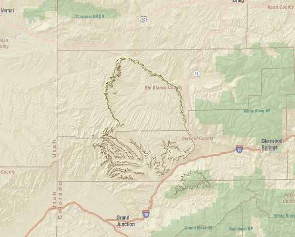